Articles by Chuck Price — Page 8

RV Overnights vs Harvest Hosts: 2026 Price & Break-Even Math

RV Overnights vs Harvest Hosts: 2026 Price & Break-Even Math

By Chuck Price | Last updated: July 21, 2026 | Data verified: July 21, 2026 | Harvest Hosts offer verified: September 29, 2026

This page helps RVers compare RV Overnights and Harvest Hosts based on budget, route fit, rig size, amenities, host network, and travel style. It also covers the Family RV Association (FRVA) member rate, which changes the RV Overnights (RVO) math for some readers and changes nothing for most.

Disclosure: Boondock or Bust is a Harvest Hosts affiliate. If you join Harvest Hosts through a link on this page, we may earn a commission at no extra cost to you. That relationship does not change the comparison below.

Quick answer: Choose RV Overnights when cost, electric-hookup filtering, and big-rig practicality matter most. Choose Harvest Hosts when you want a larger experience-driven network, based on the published host counts below. If you already hold a Family RV Association membership, RV Overnights gets cheaper still at $29.99 per year. Choose neither until you check your actual routes.

Plan terms change. Before you buy either membership, verify current pricing, refund terms, host counts, discount eligibility, and route coverage on the provider’s own website.

September 30, 2026 acquisition update: Choice Hotels agreed to acquire Harvest Hosts. Read our Choice Hotels and Harvest Hosts acquisition analysis for confirmed transaction details, member reactions, and unanswered questions about pricing and host terms.

Current Snapshot: Verified Pricing and Terms

RV Overnights now has two rates that matter, and the public one is not the only one.

Item RV Overnights Harvest Hosts Decision Impact
Public annual price $49.99/year. RVO states the rate you sign up at is the rate you keep while the subscription stays active $99 Classic, $169 with Boondockers Welcome, $179 All Access Use standard renewal pricing for long-term math, not sale pricing.
FRVA member price $29.99/year. Eligible Family RV Association members receive 40% off, locked for as long as the membership stays active No FRVA-specific rate was identified on the provider and FRVA pages reviewed on July 21, 2026 Only relevant if you already hold or already want FRVA membership.
First-year promotions Compare page showed a $39.99 first year renewing at $49.99, plus a switch code for buyers coming from a competing platform BOONDOCK20: $79.20 Classic, $135.20 with Boondockers Welcome, or $143.20 All Access. New members, first year only; verified September 29, 2026. First-year math and renewal math are different questions. Run both.
Network size Over 1,500 host locations across the US and Canada 9,600+ locations across 49 US states and 10 Canadian provinces, as of September 27, 2026. Other official Harvest Hosts pages show different totals. Harvest Hosts wins on raw network size by a wide margin.
Host support spending Suggests a minimum $30 purchase per host location Suggests a minimum $30 spend. Optional hookup fees count toward it Same expectation on both platforms. Budget for it either way.
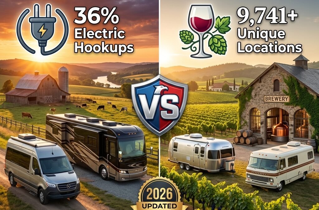
Electric hookups Comparison page lists electric hookups at 36% of locations. RVO publishes 32% elsewhere on its own site Hookups vary by host. Some offer complimentary hookups, others charge an optional fee, and you can filter for electric or water hookups in the app RVO is the better starting point if electric access is a frequent need.
Refund terms 90-day money-back guarantee Happy Camper Guarantee: the guarantee page allows a refund within 90 days if the account has completed two or fewer stays. A support article says one or fewer, so confirm in writing before relying on it Test quickly. Do not let the refund window pass unused.

Verification note: Pricing, host counts, and plan terms were checked against provider pages on July 21, 2026. Both companies change promotions and location counts often, so recheck before purchase.

Conflicting vendor data: RV Overnights publishes different host statistics on different pages of its own site. Its comparison page and FRVA partnership page both list electric hookups at 36% of locations, while its main membership page lists 32%. Additional-night availability is listed as 79% in one place and 73% in two others. Neither figure is used in the analysis below. This page uses the 36% figure and flags the discrepancy rather than presenting a single number as settled.

RV membership comparison guide showing pricing coverage and decision factors
Public pricing, member pricing, and promotional pricing are three different numbers. Compare renewal rates, not headline offers.

Start With the Job, Not the Brand

Each membership solves a different travel problem.

That sounds basic, but it is where a lot of RVers waste money. They buy the membership with the bigger name, the lower sale price, or the strongest Facebook recommendations. Then they discover the hosts do not line up with their routes, the rig is too large, the arrival window does not work, or the overnight stay itself does not remove the host-support expectation. Before you pay for either network, it is worth reading the rest of the boondocking guide to see how paid host stays compare with free public-land options.

Use this filter first

  • Need the lowest annual fee? Start with RV Overnights.
  • Already an FRVA member? Start with RV Overnights at the $29.99 member rate.
  • Need the largest host network? Start with Harvest Hosts.
  • Need electric more than occasionally? Start with RV Overnights, then verify each host.
  • Want memorable farms, wineries, breweries, attractions, and private-property stays? Start with Harvest Hosts.
  • Already have cheap public camping dialed in? You may not need either one.

The FRVA Member Rate: Who It Actually Helps

Eligible FRVA members can receive 40% off RV Overnights, reducing the current annual price from $49.99 to $29.99. Verify your membership tier qualifies at the RV Overnights FRVA offer page before checkout.

Family RV Association is the organization formerly known as the Family Motor Coach Association. RV Overnights publishes the offer on its own FRVA partnership page, lists the member price as $29.99 per year, and gives the member code as FRVA26. It states the 40% applies every year rather than the first year only, and its lifetime price lock holds your signup rate for as long as the subscription stays active. FRVA also hosts a member-facing version of the offer behind account login.

Verify current eligibility, promotional codes, and checkout pricing before joining. Codes and partner pages change without notice.

Do not join FRVA just to get this discount. FRVA dues were listed at $99 for one year, $188 for two years, and $267 for three years as of July 21, 2026. The RV Overnights discount is worth $20 per year.

Spending $99 to save $20 puts you $79 behind in year one, and the gap grows every year after, because FRVA dues recur while the $20 saving stays fixed. Five years in that is $495 in dues against $100 saved. Multi-year FRVA dues work out to roughly $94 and $89 per year, which does not change the answer. The member rate is worth taking when you already value FRVA for its magazine, medical and travel assistance, roadside coverage, tire program, insurance rates, and chapters. It is not a reason to join.

Other RV Overnights rates you may qualify for

The $49.99 public price is a list price, not the only rate available.

  • Military and first responder discount (as of July 21, 2026). RVO lists 40% off annual memberships for active duty, retired military, veterans, and their families, verified through a third-party service. See RVO’s military and first responder page for current verification requirements. This is the same 40% as the FRVA offer, with no association dues attached.
  • First-year promotional pricing (as of July 21, 2026). The RVO comparison page showed a $39.99 first year that renews at $49.99. Verify before purchase.
  • Switch promotion (as of July 21, 2026). RVO promotes a code giving 30% off the first year for buyers moving from a competing platform. Verify before purchase.
  • Loyalty program (as of July 21, 2026). RVO advertises up to 20% off membership renewals earned by staying at host locations.

Stacking is not documented. RV Overnights has not published terms confirming that the FRVA rate combines with the loyalty program, the switch code, or the military discount. Assume one discount applies at checkout and confirm with RVO support before you count on a combined rate. Do not build your budget around a stack that has not been verified.

The Real Cost: Use Two Break-Even Models

Break-even math is useful only when the assumptions are visible.

Membership-fee-only break-even and total cash outlay answer different questions. Mixing them produces a number that flatters whichever membership you already wanted. Run both models separately. Both tables below round up to whole nights, because a partial night does not recover a fee.

Model 1: Membership-Fee-Only Break-Even

This model asks one narrow question: how many avoided campground nights does it take to recover the membership fee?

Formula: annual membership fee divided by estimated nightly campground savings equals break-even stays. You cannot take a fraction of a stay, so round up to the next whole stay. Quotients are shown to two decimal places.

Membership Illustrative Fee If You Avoid a $55 Campground Night What It Means
RV Overnights, FRVA member rate $29.99 $29.99 ÷ $55 = 0.55, rounded up to 1 stay Lowest annual outlay on this page. Requires active FRVA membership.
RV Overnights, public rate $49.99 $49.99 ÷ $55 = 0.91, rounded up to 1 stay Fast fee recovery, but only if host locations fit your route.
Harvest Hosts Classic $99 $99 ÷ $55 = 1.80, rounded up to 2 stays Reasonable for travelers who want the experience, not just parking.
Harvest Hosts + Boondockers Welcome $169 $169 ÷ $55 = 3.07, rounded up to 4 stays Adds private-property hosts to the small-business network.
Harvest Hosts All Access $179 $179 ÷ $55 = 3.25, rounded up to 4 stays Best for heavier users who want the widest network.

Model 2: Conservative Cash-Outlay Break-Even

This model includes expected host-support spending. It is more conservative, and more honest for budget planning.

Assumption: If your alternative campground is $55 and you expect to spend about $30 supporting the host, your estimated cash savings is about $25 per stay. Divide the fee by $25 and round up to the next whole stay. Your real savings may be higher or lower depending on what you would have bought anyway.

Membership Illustrative Fee Using $25 Estimated Savings Per Stay Reality Check
RV Overnights, FRVA member rate $29.99 $29.99 ÷ $25 = 1.20, rounded up to 2 stays Lowest risk entry point if you already hold FRVA membership.
RV Overnights, public rate $49.99 $49.99 ÷ $25 = 2.00, rounded up to 2 stays Good math if route fit is strong.
Harvest Hosts Classic $99 $99 ÷ $25 = 3.96, rounded up to 4 stays Fair if you value the destination experience.
Harvest Hosts + Boondockers Welcome $169 $169 ÷ $25 = 6.76, rounded up to 7 stays Needs steady use across a full travel season.
Harvest Hosts All Access $179 $179 ÷ $25 = 7.16, rounded up to 8 stays Works best for frequent travelers, not occasional weekend use.

What the FRVA rate does not do: at these illustrative assumptions only, the member rate does not change the break-even stay count. At a lower campground alternative it can. Against a $35 night, the public rate needs 2 stays under Model 1 while the member rate needs 1. Public and member pricing both recover in one stay under Model 1 and two stays under Model 2. The discount saves $20 a year in cash. It does not make the membership work on routes where the hosts are not there. Route fit is still the deciding variable.

How BOONDOCK20 changes first-year break-even

New members receive 20% off any Harvest Hosts plan for the first year only. The offer link displayed these prices on September 29, 2026. The existing tables use list prices for comparison; the table below applies the same assumptions to the discounted first year.

Plan Annual list price First year with BOONDOCK20 Stays at $55 savings Stays at $25 net savings
Classic $99 $79.20 2 4
Harvest Hosts + Boondockers Welcome $169 $135.20 3 6
All Access $179 $143.20 3 6

Stays are rounded up. Host purchases, optional fees, taxes, and detours can change your actual costs. BOONDOCK20 does not discount renewals; confirm the then-current renewal rate and do not assume offers stack.

Do not treat these examples as guaranteed savings. They are decision math. Your numbers change if your campground alternative is $35, if you spend $60 at wineries, if you buy on a first-year promotion, or if the host is twenty miles off your route.

Route Fit Matters More Than Total Host Count

A bigger network is worthless if it is not on your route.

Harvest Hosts has the larger network. Its homepage lists 9,600+ locations across all its programs as of September 27, 2026, roughly six times the RVO count cited above, and Classic alone covers fewer. That gives it an obvious advantage for national coverage, last-minute reroutes, and travelers who cross different regions often. RV Overnights is smaller, so it requires more pre-checking. Its lower price only matters if you can actually use the hosts.

The route test

  1. Open both provider maps. Cross-check against your usual free campsite finder apps so you can see paid and free options on the same routes.
  2. Plot your next three planned travel days, not dream trips.
  3. Count usable hosts within roughly 30 to 50 miles of your actual route.
  4. Remove any host that cannot fit your rig, pets, arrival timing, or power needs.
  5. Buy only if the remaining usable hosts justify the annual fee.

That final count matters more than marketing totals. One perfectly placed host beats fifty beautiful locations you would never drive near.

Rig Size, Hookups, and Arrival Rules Can Decide It Fast

Hard requirements beat brand preference.

Choose RV Overnights first if:

  • You want the lowest standard annual fee, at either the public or FRVA rate.
  • You need better odds of finding electric hookups.
  • You drive a large rig and want to filter on rig length before you commit, subject to host-specific limits.
  • You are willing to check the map before every trip.
  • You prefer functional transit stops over destination-style experiences.

Choose Harvest Hosts first if:

  • You want the larger host ecosystem.
  • You value farms, wineries, breweries, attractions, and private-property stays.
  • You travel across regions and want more fallback options on unfamiliar routes.
  • You are comfortable dry camping most of the time.
  • You want a longer-established platform with a larger body of member reviews.

If Harvest Hosts fits your travel style, use BOONDOCK20 for 20% off any plan. This offer is for new members, first year only; the link below applies the code automatically.

Compare Harvest Hosts plans and save 20%

Side by side RV membership app screens comparing map and filter tools
Run the route test in both apps before you pay. Filter counts matter less than usable hosts on your next three travel days.

Before You Join Harvest Hosts: The Questions New Members Ask

Prospective members raise the same questions again and again in Harvest Hosts owner groups.

What does a stay really cost beyond the membership?

Harvest Hosts does not charge a camping fee. It suggests spending a minimum of $30 in support of your host, and the company is explicit that this is a suggestion, not a fee. Hookup fees and extra-night fees are set by each host, are optional, and count toward that $30.

Can hosts charge pet fees?

Harvest Hosts has not published a rule on pet fees, and member reports on this point differ, so read each host’s listing before you request a stay. The company does say that a large majority of hosts allow pets on a leash, and you can use the pets-allowed filter in the app to narrow your search.

What if I need power?

Hookups are called out on host profiles and filterable in the app, but they are never guaranteed. No official amperage filter for 30-amp or 50-amp service was found. If reliable power is a requirement, plan on a campground instead.

What about generators and quiet hours?

The Code of Conduct asks members to run generators only between 8am and 10pm, or the host’s own quiet hours if they are stricter, and to check local regulations. Each host sets its own generator rules, usually posted on its profile, and you can filter for hosts that allow generators before you request a stay.

What are the arrival and business-hour rules?

You must arrive during business hours unless the host says otherwise, and gates can close after hours. Message the host with your ETA before you leave. Member accounts include first stays that went badly because the traveler arrived just before closing and never met the host.

How do I avoid hidden-fee surprises?

Read the full listing, the reviews, and the photos before you request a stay, and use the rig-length filter so you are not guessing. Check the entrance on satellite imagery if the description mentions a tight turn, and confirm any hookup or extra-night fee with the host before you arrive. For more on avoiding surprise costs generally, see the hidden costs of free RV parking.

Does the Harvest Hosts app navigate for me?

The app gives you a map with filters and a trip planner with a route-radius slider. Harvest Hosts does not describe in-app turn-by-turn navigation. After a stay is approved, it gives the address with an Open in Google Maps option and GPS coordinates. Harvest Hosts also integrates with RV LIFE Trip Wizard, though Boondockers Welcome hosts do not appear there.

Can I start with Classic and upgrade later?

Yes. You can upgrade anytime from your dashboard or the app, and Harvest Hosts prorates the cost so you only pay for the new tier for the rest of your current membership year. Downgrades work the other direction and take effect at your next renewal.

Harvest Hosts vs Boondockers Welcome, in two sentences

Harvest Hosts hosts are businesses, such as farms, wineries, breweries, and attractions, where a purchase is expected. Boondockers Welcome hosts are private residences with no purchase necessary, and it can be bought standalone or added to a Harvest Hosts plan. For background on how the two programs came together, see our Harvest Hosts and Escapees coverage.

When is a campground the better choice?

Choose a campground instead when you need several nights in one place, full hookups every night, a late arrival, or your rig is not self-contained, since Harvest Hosts requires self-containment even at hosts that offer hookups. For a broader look at how paid host stays stack up against other options, see this boondocking cost breakdown.

Who Harvest Hosts is not a good fit for

  • You need hookups every night. Harvest Hosts requires a self-contained RV and does not guarantee power at any host.
  • You do not want to buy anything. Harvest Hosts suggests spending at least $30 to support each host.
  • You camp in a tent, including a rooftop tent. Tent camping of any kind is not allowed.
  • You mostly stay multiple nights in one place. A stay is one free night, and extra nights are up to the host and may cost extra.
  • You need guaranteed same-day or last-minute bookings everywhere. Same-day requests only work where a host allows them.

If the route test and the stay rules above fit how you travel, compare the current plans on the Harvest Hosts site.

Save 20% on a Harvest Hosts plan

The $30 Host-Support Question

The stay is not the same as a free parking lot.

Both platforms now use the same framing. Harvest Hosts support documentation asks members to spend a minimum of $30 in support of the host, and notes that products, experiences, and optional hookup fees all count toward that amount. RV Overnights membership guidelines suggest a minimum $30 purchase per host location and encourage members to spend more. Neither company bills it as a camping fee, and neither treats it as a hard charge, but the expectation is explicit on both sides.

That support may be wine, produce, dinner, a museum admission, an electric hookup fee, or a donation where the host has nothing to sell. You are not paying a campground fee. You are participating in the exchange that keeps small-business hosts in the network.

Budget rule: If spending about $30 at a host would feel like a burden, these memberships are probably not your cheapest option, and a $20 discount will not fix that. Look at public lands under current BLM rules, state parks, budget campgrounds, casino stops, or the free overnight parking that is still available instead.

Common Mistakes That Waste Money

Most bad memberships come from bad assumptions.

Mistake 1: Buying before checking the map

Do not buy based on total host count. Buy based on the hosts that fit your next real trips.

Mistake 2: Buying a club membership to chase a discount

A $99 association membership that unlocks $20 in savings is a $79 loss unless you wanted the association anyway. Price the parent membership on its own merits first, then treat the partner discount as a bonus.

Mistake 3: Treating host support as optional in the budget

You might not spend exactly $30 every time, but you should plan for it. That keeps your cost math honest.

Mistake 4: Ignoring your rig size

Host access roads, turnarounds, slopes, and parking surfaces matter. Check the host profile, then confirm directly when the fit looks tight.

Mistake 5: Assuming hookups are available

Both programs are built around self-contained RVs. Hookups are a bonus, not a guarantee. If power is critical, carry a backup plan.

Mistake 6: Arriving like it is a campground

These are businesses and private properties. Follow arrival windows, ask about generator rules, and do not treat the host as a 24-hour check-in desk.

My Practical Recommendation

Start with the cheapest rate you already qualify for, but only when it fits your routes.

If you already hold an FRVA membership, RV Overnights at $29.99 is the lowest-risk test on this page. Log in to the FRVA member offer page, pull your code, and run the route test before you check out. If you qualify for the military or first responder discount instead, you reach the same 40% without association dues.

If you are cost-sensitive and hold neither, RV Overnights at the public rate is still the cheaper entry, provided the map shows usable hosts on your next several trips. The 90-day guarantee reduces the risk. Do not join FRVA to close a $20 gap.

If you want a larger experience-driven network, start with Harvest Hosts Classic. If you also want Boondockers Welcome, golf courses, and the widest combined network, price All Access against your real expected use. At eight break-even stays at list price, or six first-year stays with BOONDOCK20 under the conservative model, All Access needs a genuine travel season behind it. Do not buy it because the location count looks impressive.

If you travel a lot, both memberships can make sense. Buy both only after your route test proves they solve different problems for you.

RV membership decision flow chart for choosing the best overnight program
Decision order: confirm which rate you qualify for, run the route test, then buy inside a refund window you can still use.

Frequently Asked Questions

These are the questions that usually decide the purchase.

Which is cheaper, RV Overnights or Harvest Hosts?

RV Overnights is cheaper on annual fee at either rate. As of July 21, 2026, RV Overnights listed a public price of $49.99 per year, and eligible Family RV Association members can receive 40% off, which brings the annual price to $29.99. Harvest Hosts listed standard plans at $99, $169, and $179 per year. Both companies also run first-year promotions, so verify current checkout pricing before buying.

How much is the RV Overnights FRVA member discount?

Eligible Family RV Association members can receive 40% off RV Overnights, reducing the current annual price from $49.99 to $29.99. RV Overnights publishes the member code FRVA26 on its own FRVA partnership page, states the 40% applies every year, and locks your signup rate for as long as the subscription stays active. Verify current eligibility, promotional codes, and checkout pricing before joining.

Is it worth joining FRVA just to get the RV Overnights discount?

No. Family RV Association dues were listed at $99 for one year as of July 21, 2026, and the RV Overnights discount saves $20 per year. Paying $99 to save $20 leaves you $79 behind. The discounted rate makes sense only when you already want FRVA membership for its other benefits, such as the magazine, medical and travel assistance, roadside coverage, and the tire program.

Does either membership replace campgrounds?

No. Both are best treated as one-night or short-stay tools, not campground replacements. You still need commercial parks or public campgrounds for guaranteed hookups, laundry, dump stations, or longer destination stays.

Do I have to spend $30 at every host?

Treat $30 as expected host-support money, not a campground fee. Both platforms use suggested-minimum language. Harvest Hosts suggests spending a minimum of $30 in support of your host, and RV Overnights suggests a minimum $30 purchase. Harvest Hosts also counts the cost of optional hookups toward that $30.

Which membership is better for electric hookups?

RV Overnights is the better starting point if electric access matters because its comparison page lists electric hookups at 36% of locations. RV Overnights publishes a conflicting 32% figure on its own membership page, so treat 36% as the comparison-page figure as of July 21, 2026. Harvest Hosts says hookups vary by host. Some hosts offer them free, others charge an optional fee, and you can filter for electric or water hookups in the app.

Should frequent RV travelers use both memberships?

Some frequent travelers may benefit from using both, but only after checking route fit. Do not buy both because they overlap. Buy both only when your actual routes show enough usable hosts on each platform.

What should I check before buying either membership?

Check current pricing and which discount you actually qualify for, refund terms, host density along your next three routes, rig length limits, hookup needs, pet rules, arrival windows, and whether you can comfortably support hosts during each stay.

How much does a Harvest Hosts membership cost in 2026?

As of September 29, 2026, Harvest Hosts lists Classic at $99 per year, Harvest Hosts + Boondockers Welcome at $169, and All Access at $179. Code BOONDOCK20 gives new members 20% off any plan for the first year only: $79.20, $135.20, and $143.20 respectively. Our offer link applies the code automatically. Renewals are at the then-current rate; verify the total and terms at checkout.

Does Harvest Hosts offer a military discount?

No Harvest Hosts-specific veteran or military discount was found on its official pages as of September 27, 2026. Harvest Hosts states that discount codes are sometimes offered for special-status users, including veterans, during seasonal sales, but no standing veteran code or amount is published. The Escapees RV Club membership bundled with All Access does offer a free membership for active duty service members.

Can I upgrade my Harvest Hosts membership later?

Yes. You can upgrade from Classic to a higher tier anytime from your dashboard or the app, and Harvest Hosts prorates the cost so you pay only for the new tier for the rest of your membership year. Downgrades are also available and take effect at your next renewal.

Related RV Overnights Guides

Use these active cluster pages for deeper review and three-way membership comparison.

Sources and Verification

Every price, host count, and program term on this page was checked against the provider’s own published pages on July 21, 2026.

  1. Family RV Association. “RV Overnights.” Member offer page. Accessed July 21, 2026. https://frva.com/rvovernights
  2. Family RV Association. “Family RV Association Enters Exclusive Partnership With RV Overnights.” Accessed July 21, 2026. https://www.frva.com/family-rv-association-enters-exclusive-partnership-with-rv-overnights
  3. Family RV Association. “Membership Types.” Accessed July 21, 2026. https://frva.com/why-join-frva-club
  4. RV Overnights. “Exclusive FRVA Partnership.” Accessed July 21, 2026. https://rvovernights.com/pages/frva
  5. RV Overnights. “RV Membership.” Accessed July 21, 2026. https://rvovernights.com/pages/rv-membership
  6. RV Overnights. “Compare Us.” Accessed July 21, 2026. https://rvovernights.com/pages/compare-us
  7. RV Overnights. “Membership Resources.” Accessed July 21, 2026. https://rvovernights.com/pages/membership-resources
  8. RV Overnights. “Military and First Responder Discount.” Accessed July 21, 2026. https://rvovernights.com/pages/military-first-responder-discount
  9. Harvest Hosts. “Membership Plans.” Accessed July 21, 2026. https://www.harvesthosts.com/plans
  10. Harvest Hosts Support. “Completing – How much should I spend at a Host location?” Updated April 1, 2026. Accessed July 21, 2026. https://support.harvesthosts.com/en/articles/6110801-completing-how-much-should-i-spend-at-a-host-location
  11. Harvest Hosts Support. “Do Hosts offer Hookups in Harvest Hosts?” Updated January 7, 2026. Accessed July 21, 2026. https://support.harvesthosts.com/en/articles/6111730-do-hosts-offer-hookups-in-harvest-hosts

Methodology: Pricing and program terms come from provider-published plan pages, member offer pages, and public policy documentation. The $29.99 FRVA member price and the FRVA26 member code are published publicly by RV Overnights on its own FRVA partnership page, and the $29.99 figure is separately confirmed in the Family RV Association partnership announcement. Final checkout pricing depends on eligibility verification. Claims that could not be verified cleanly were removed, softened, or labeled as unverified.

Discount stacking: No published terms confirm that the FRVA rate combines with the RV Overnights loyalty program, switch code, or military discount. This page does not claim they stack.

Data last verified: July 21, 2026

Harvest Hosts Discount Code: BOONDOCK20 Saves 20%

BOONDOCK20 saves new members 20% on any Harvest Hosts plan for the first year only. The link below applies the code automatically. Harvest Hosts confirmed these terms on September 29, 2026. The discount changes the first-year purchase price, but it does not change the underlying decision: check host coverage along your actual routes, rig requirements, and the current renewal price before joining.


Save 20% on Harvest Hosts

The Endless Rally: How to Hit 20 Adult-Only Motorcycle Rallies in One 2026 Road Trip

The Endless Rally: How to Hit 20 Adult-Only Motorcycle Rallies in One 2026 Road Trip

By Chuck Price | Published: March 5, 2026 | Last Reviewed: June 4, 2026

The Endless Rally is a long-distance 2026 road trip plan that connects 20 adult-only or age-restricted motorcycle rally stops across one riding season.

The route runs from March 12 through November 7, 2026. It starts in Oklahoma, loops through Texas, Iowa, Illinois, Tennessee, New York, Kentucky, Indiana, Ohio, Maryland, Maine, and Florida, then closes the season in Lakeland. Starting and ending near Albany, New York, expect roughly 14,000 to 15,000 total driving miles depending on exact roads, detours, weather, and home-base routing.

This is not a simple weekend rally trip. It is a season-long biker route built for riders with schedule flexibility, a reliable bike or tow rig, a realistic fuel budget, and the discipline to skip a stop if the route gets too tight.

Important planning note: Adult motorcycle rallies can change dates, venues, ticket rules, age policies, camping rules, and entry restrictions with little notice.

Use this as a route-planning framework, not a booking contract. Confirm every event directly with the organizer before buying tickets, reserving campsites, or committing long-distance travel. For a broader event list, see our Comprehensive 2026 Adult Rally Calendar.

2026 Endless Rally Route at a Glance

This route connects 20 adult-only or age-restricted motorcycle rally stops from March through November 2026.

Weathered United States road map with motorcycle gloves keys and coffee

  • Season window: March 12 through November 7, 2026.
  • Total core stops: 20 adult-only or age-restricted rallies.
  • Estimated route distance: Roughly 14,000 to 15,000 miles when starting and ending near Albany, NY.
  • Primary rally states: Oklahoma, Texas, Iowa, Illinois, Tennessee, New York, Kentucky, Indiana, Ohio, Maryland, Maine, and Florida.
  • Best home-base reset: Harley Rendezvous in Pattersonville, New York, especially for Northeast-based riders.
  • Hardest logistics window: New Portland, Maine to Bloomville, Ohio to Conesville, Iowa between August 23 and September 3.

Key Planning Notes Before You Use This Route

This route works best as a flexible rally framework, not a rigid itinerary.

  • The route runs into November. Roscoe’s Chili Challenge in Lakeland, Florida closes the 20-stop route on November 5-7, 2026.
  • Route 66 remains the Oklahoma hub. Depew appears three times in the core route because Route 66 Rally Grounds hosts several age-restricted biker rallies during the season.
  • JuneBug Boogie has two 2026 stops. The spring rally is listed for June 18-21 and the fall rally for September 24-27.
  • Some rows need final organizer confirmation. Third-party listings are useful for planning, but they should not replace direct confirmation before buying tickets or reserving campsites.
  • This is a route framework, not a promise that every rider can make every stop. Weather, fatigue, work schedules, bike issues, and sold-out camping can all change the plan.

The 20-Stop Route

The table below is the current route order for the 2026 Endless Rally.

“Official organizer” means the date was found on an event or organizer site. “Official ticket page” means the date was found on the event’s ticket or application page. “Official social” means the date was found on the organizer’s public social page. “Third-party listing” means the date should be treated as useful but still verified before travel.

Stop Rally Location 2026 Dates Age Source Basis
1 Route 66 Cabin Fever Rally Depew, OK March 12-15 21+ Official organizer and event listings
2 Thunder in the Hill Country Bandera, TX March 26-29 21+ Official organizer
3 Route 66 BikeStock Oklahoma Depew, OK April 30-May 3 21+ Official organizer and event listings
4 Crater Rally Spring Somerville, TX May 14-17 21+ Official organizer
5 Redneck Revival Memorial Day Conesville, IA May 21-24 21+ Third-party listing, verify
6 Hogrock River Rally Cave-In-Rock, IL June 11-14, early bird June 10 18+ Official organizer and listings
7 JuneBug Boogie Spring Cookeville, TN June 18-21 21+ Official organizer
8 Harley Rendezvous Classic Pattersonville, NY June 25-28 21+ Official organizer
9 ABATE of Iowa Freedom Rally Algona, IA July 2-4 18+ Official organizer
10 Sturgis Kentucky Bike Rally Sturgis, KY July 15-19 21+ Official organizer and ticket page
11 ABATE of Indiana The Boogie Springville, IN July 16-19 18+ Official organizer
12 Wetzelland Grover Hill, OH July 23-26 21+ Official organizer
13 East Coast Sturgis Oldtown, MD August 3-9, official start August 5 21+ Official ticket page
14 United Bikers of Maine Statewide New Portland, ME August 19-23 21+, members only Official social and UBM site
15 Easyriders Rodeo Bloomville Bloomville, OH August 28-September 1 Verify gate policy Official event application page
16 Redneck Revival Labor Day Conesville, IA September 3-6 21+ Third-party listing, verify
17 JuneBug Boogie Fall Cookeville, TN September 24-27 21+ Official organizer
18 Hogrocktoberfest Cave-In-Rock, IL October 1-4, early bird September 30 18+ Official organizer
19 Route 66 Fall Biker Rally Depew, OK October 15-18 21+ Official organizer and event listings
20 Roscoe’s Chili Challenge Lakeland, FL November 5-7 21+ Official organizer

Leg 1: Oklahoma to Texas Spring Kickoff

This leg starts the route with a long southern push.

If you are leaving from the Albany, New York area, plan on several travel days before the first rally. This is the hardest mental part of the trip because the season starts before northern riding weather fully settles in.

Stop 1: Route 66 Cabin Fever Rally, Depew, OK, March 12-15. Route 66 Rally Grounds works as the launch point because the same venue hosts several age-restricted biker rallies during the season. The route uses Depew more than once, which makes it a practical mid-continent anchor.

Stop 2: Thunder in the Hill Country, Bandera, TX, March 26-29. Bandera gives the route its Texas Hill Country leg. Riders have enough time between Depew and Bandera to avoid rushing, explore the Hill Country, and use Bandera as a warm-weather reset before returning north later in spring.

What this leg does not cover: This is not a ride-by-ride Texas Hill Country guide. Confirm local road conditions, event gate rules, and lodging options before leaving Oklahoma.

Leg 2: Back Through Oklahoma, Texas, and Iowa

This leg contains the tightest early-season transfer.

Stop 3: Route 66 BikeStock Oklahoma, Depew, OK, April 30-May 3. This second Depew stop is where the hub strategy starts to make sense. Riders with local storage, a friend nearby, or a long-term site arrangement can avoid hauling everything for the full route.

Stop 4: Crater Rally Spring, Somerville, TX, May 14-17. The Crater Rally runs at Welch Park on Lake Somerville. This is another Texas stop before the route makes the big move north toward Iowa.

Stop 5: Redneck Revival Memorial Day, Conesville, IA, May 21-24. This remains the tightest early-season transition. The Somerville-to-Conesville move is roughly 900-plus miles depending on the route. Build in a margin for weather, mechanical issues, and recovery time.

Routing caution: If you fall behind after Crater Rally, the Memorial Day Conesville stop is the first one to consider dropping. Forcing this leg while tired creates the highest risk window in the first half of the route.

What overrides this plan: Weather, mechanical trouble, or late departure from Texas should override the rally count. This route only works if you are willing to skip a stop when the schedule gets tight.

Leg 3: Midwest to Tennessee to New York

This leg is the first efficient eastbound stretch.

Stop 6: Hogrock River Rally, Cave-In-Rock, IL, June 11-14. June 10 is treated as early-bird arrival. Plan June 10 only if you want to arrive early and the organizer still offers early entry when you book.

Stop 7: JuneBug Boogie Spring, Cookeville, TN, June 18-21. The official event page lists June 18-21 for the spring rally and September 24-27 for the fall rally. This route uses both 2026 JuneBug stops.

Stop 8: Harley Rendezvous Classic, Pattersonville, NY, June 25-28. This is the first major Northeast home-base opportunity for riders from New York, New England, or the Mid-Atlantic. For an Albany-area rider, Pattersonville is close enough for laundry, mail, mechanical checks, and resupply.

For RVers shadowing this route, build in your own overnight strategy. Our free campsite apps guide can help with route gaps between rally grounds.

Leg 4: July Split Attendance

July is the densest part of the route.

The Sturgis Kentucky Bike Rally and ABATE of Indiana’s The Boogie overlap, but they are close enough to split if the goal is to touch both events instead of fully attending one.

Stop 9: ABATE of Iowa Freedom Rally, Algona, IA, July 2-4. This is the Fourth of July anchor. The official ABATE of Iowa listing shows July 2-4 at ABATE Freedom Park in Algona.

Stop 10: Sturgis Kentucky Bike Rally, Sturgis, KY, July 15-19. The full rally dates are July 15-19. For this route, attend the opening stretch and use it as the first half of the July split.

Stop 11: ABATE of Indiana The Boogie, Springville, IN, July 16-19. The full Boogie dates are July 16-19. The practical split is to spend July 15-16 in Sturgis, then make the roughly 110-mile, 2.5-to-3-hour transfer to Springville for July 17-19. You miss part of both events, but you gain two rally stops without a major geography penalty.

Stop 12: Wetzelland, Grover Hill, OH, July 23-26. Wetzelland follows cleanly from Indiana and keeps the route moving north and east before the August East Coast stretch.

Motorcycle handlebars facing a long empty Midwest highway at sunset

What split attendance costs: You miss the back half of Sturgis Kentucky and the opening part of The Boogie. This tactic only makes sense if touching both rallies matters more than staying put for one full event.

Leg 5: Maryland, Maine, and the Hardest Northeast Transfer

This leg is where the route gets harder.

Stop 13: East Coast Sturgis, Oldtown, MD, August 3-9. Some listings show the official rally running August 5-9, with early entry beginning August 3. For route planning, treat August 3-9 as the available event window and confirm ticket details before travel.

Stop 14: United Bikers of Maine Statewide, New Portland, ME, August 19-23. UBM lists the 2026 Statewide dates as August 19-23. UBM also describes Statewide as a members-only event for those 21 or older, with membership available at the gate or online. Confirm membership and entry rules directly with UBM before relying on gate access.

Planning note: New Portland, Maine to Bloomville, Ohio is roughly 800-plus miles depending on route. Bloomville to Conesville, Iowa is another roughly 500-plus miles. Recheck both legs in your routing app before committing.

What overrides this plan: If Maine weather, fatigue, or bike trouble slows you down, skip Bloomville or Conesville. The August-to-September chain is workable, but it has little slack.

Leg 6: Ohio and Iowa Labor Day Routing

This leg links the Ohio rally window to the Iowa Labor Day weekend stop.

Stop 15: Easyriders Rodeo Bloomville, Bloomville, OH, August 28-September 1. Current Easyriders event materials list Bloomville, Ohio at Smokin’ Cole Farms for August 28-September 1. This gives riders a workable route from Maine to Ohio before heading west to Iowa.

Stop 16: Redneck Revival Labor Day, Conesville, IA, September 3-6. This listing places the event on the weekend immediately before Labor Day 2026, which falls on Monday, September 7. Confirm the promoter’s current dates before treating this as a locked stop.

Labor Day routing note: The Ohio-to-Iowa transfer is not a casual hop. Build in fuel, sleep, and weather margin before committing to both stops.

Leg 7: Tennessee, Illinois, Oklahoma, and Florida

The final leg turns this into a November route.

Stop 17: JuneBug Boogie Fall, Cookeville, TN, September 24-27. This is the second Cookeville stop of the season. The fall version gives the route a cleaner move out of Iowa before the October stretch.

Stop 18: Hogrocktoberfest, Cave-In-Rock, IL, October 1-4. September 30 is listed as early-bird arrival. Use October 1-4 as the main event window unless the organizer confirms an early-entry plan that fits your travel schedule.

Stop 19: Route 66 Fall Biker Rally, Depew, OK, October 15-18. This is the third Depew stop on the core route. It completes the Route 66 hub concept while giving riders a mid-October Oklahoma anchor.

Stop 20: Roscoe’s Chili Challenge, Lakeland, FL, November 5-7. This is the season closer. Adding Lakeland extends the Endless Rally into November, but it keeps the 20-stop adult-only route intact.

For RVers continuing into Florida, plan water and waste stops before the long southbound push. Our fresh water management guide and RV dump station guide cover the two systems most likely to force an unplanned stop.

Route Stats and Logistics

The route is a framework, not turn-by-turn navigation.

  • Total rally stops: 20 core stops
  • Season window: March 12-November 7, 2026
  • Age-restricted mix: Mostly 21+, with several 18+ events
  • Rally states: Oklahoma, Texas, Iowa, Illinois, Tennessee, New York, Kentucky, Indiana, Ohio, Maryland, Maine, and Florida
  • Estimated driving distance: Roughly 14,000 to 15,000 miles when starting and ending near Albany, NY. This is a broad waypoint estimate, not a live GPS calculation.
  • Hardest travel window: Somerville, TX to Conesville, IA after Crater Rally
  • Hardest Northeast-to-Midwest transfer: New Portland, ME to Bloomville, OH to Conesville, IA between August 23 and September 3
  • Best home-base resupply window: Harley Rendezvous in Pattersonville, NY, especially for Northeast-based riders
  • Navigation warning: For larger RVs, do not rely only on consumer map apps. Use the route as a planning concept and cross-check low bridges, restricted roads, and clearance risks with a safer routing stack. See our free truck GPS apps for RVers guide.

What to Verify Before You Commit

Every time-sensitive entry needs one final organizer check.

  1. Gate age policy: Confirm 18+ or 21+ entry rules directly with every organizer. Do not rely on older flyers or third-party summaries.
  2. Camping rules: Verify RV hookups, generator rules, tent camping, early arrival, and re-entry before showing up.
  3. Ticket status: Several events sell wristbands, camping, and parking separately.
  4. Overlap plans: If you split Sturgis Kentucky and The Boogie, accept that you will miss part of each rally.
  5. Labor Day sequencing: Confirm Easyriders Bloomville and Redneck Revival Labor Day before booking. This is a tight Ohio-to-Iowa move.
  6. Florida finish: Roscoe’s Chili Challenge is the adult-only November closer, but it adds a major southbound leg after Oklahoma.
  7. Route apps: Use RV-safe or motorcycle-aware routing where appropriate. This article is a sequencing guide, not a turn-by-turn navigation plan.

Who Should Attempt the Full Endless Rally?

The full route is for riders who want a season-long project.

This is not a simple vacation. You need schedule flexibility, a reliable rig, a realistic fuel budget, and the discipline to skip a stop if the calendar gets too tight.

The better version for most people is not all 20 stops. It is a regional slice. Start with the June and July Midwest loop, or build a Northeast version around Harley Rendezvous, East Coast Sturgis, and UBM Maine.

Best practical version: Use this article as a menu, then build a 5-stop or 8-stop route that fits your calendar.

The full 20-stop route is possible. It is not the smartest choice for every rider.

Sources Checked for This 2026 Route

Sources were checked on June 4, 2026. Organizer pages, official ticket pages, and official social pages were preferred. Third-party event calendars were used only when organizer confirmation was not publicly available or when they added useful cross-check detail.

Looking for a full state-by-state directory of every event? Check out our Comprehensive 2026 Adult Rally Calendar.


Chuck Price is the founder of Boondock or Bust, a camping and RV website. He has 35+ years of RV travel experience across 47 U.S. states.

{
“@context”: “https://schema.org”,
“@type”: “Article”,
“headline”: “The Endless Rally: 20 Adult-Only Motorcycle Rally Stops in One 2026 Road Trip”,
“description”: “A 2026 motorcycle rally route connecting 20 adult-only or age-restricted biker rally stops from March through November, with dates, source-basis notes, routing cautions, and planning guidance.”,
“author”: {
“@type”: “Person”,
“name”: “Chuck Price”,
“url”: “https://boondockorbust.com/about/”,
“sameAs”: [
“https://measurableseo.com”,
“https://www.searchenginejournal.com/author/chuck-price/”
]
},
“publisher”: {
“@type”: “Organization”,
“name”: “Boondock or Bust”,
“url”: “https://boondockorbust.com”
},
“datePublished”: “2026-03-05”,
“dateModified”: “2026-06-04”,
“mainEntityOfPage”: {
“@type”: “WebPage”,
“@id”: “https://boondockorbust.com/blog/the-endless-rally-how-to-hit-20-adult-only-motorcycle-rallies-in-one-2026-road-trip/”
}
}

Free Truck GPS Apps for RVers: Smart Backup Tool or Risky Shortcut?

Free Truck GPS Apps for RVers: Smart Backup Tool or Risky Shortcut?


Quick Answer

Free truck GPS apps like TruckMap can help RVers check routes for low bridges, weight limits, and restricted roads. TruckRouter.com adds free desktop pre-trip planning with height, weight, and clearance restriction data. Both are useful as secondary safety checks, not as dedicated RV GPS replacements. Truck-routing tools are built for commercial 18-wheelers and do not account for campground access roads, propane restrictions, or RV-specific points of interest. Use them alongside Google Maps and campground arrival instructions, not instead of either.

If you drive a Class A motorhome, a tall fifth wheel, or anything over 10 feet tall, Google Maps has a blind spot that matters. It does not know your vehicle height, length, weight, or propane status. It cannot warn you about a low bridge until you are staring at it through your windshield.

That is not speculation. The U.S. government’s own GPS.gov website confirms it: consumer GPS apps generally do not warn drivers of restricted roads, low bridges, or other information relevant to commercial motor vehicles (GPS.gov, Truck Traffic Routing). The FMCSA has warned that using non-commercial GPS devices in large vehicles contributes to preventable bridge strikes and has issued guidance urging commercial vehicle operators to use navigation systems designed for their vehicle type (FMCSA, Bridge Strike FAQ).

So what can RVers do about it without paying for another subscription? Free truck-routing apps exist. Some of them are genuinely useful as backup planning tools. But most “free RV GPS” advice online is either outdated, subscription-gated, or not actually RV-specific. This guide explains where free truck GPS tools fit, where they fall short, and how to build a safer routing stack without pretending any single app is magic.

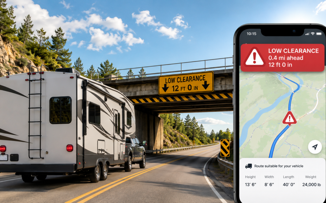
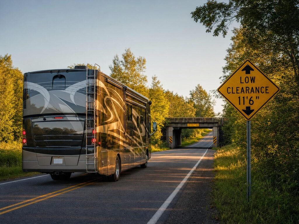
Class A Motorhome Approaching Low Clerance Bridge

Consumer GPS apps do not warn RVers about low bridges or restricted roads. Free truck GPS tools can fill part of that gap.

Why Google Maps Is Not Enough for Bigger RVs

Google Maps is excellent for drive time, traffic conditions, and finding gas stations. It is not designed for vehicles taller than a standard passenger car. Google Maps does not accept vehicle height, length, weight, or axle count as routing inputs. It cannot filter routes by bridge clearance, weight restriction, or propane prohibition.

As of May 2026, that limitation has no workaround. There is no paid upgrade that adds RV-specific routing to Google Maps. The app routes all vehicles identically, regardless of size.

For a passenger car, this is fine. For a 13-foot-tall fifth wheel or a 45-foot Class A motorhome, it creates real hazards:

  • Low bridge clearances that Google does not flag until you are committed to the road
  • Weight-restricted roads that may not support a loaded RV and tow vehicle
  • Parkways and scenic routes that prohibit commercial vehicles and large RVs
  • Narrow mountain switchbacks where turning radius matters
  • Tunnel restrictions that prohibit vehicles carrying propane

The same limitation applies to Waze and Apple Maps. All three are consumer GPS tools designed for cars.

⚠️ Common Misconception

Myth: “Low bridge strikes only happen to semi trucks. RVers don’t need to worry about clearance routing.”

Why it persists: Most bridge strike reporting focuses on commercial trucking incidents, making it easy to assume the problem does not apply to recreational vehicles.

Reality: Industry safety reports estimate that roughly 15,000 bridge strikes occur annually in the United States, many involving vehicles relying on consumer-grade GPS that does not account for clearance restrictions (FMCSA, Bridge Strike Prevention). RV forums document bridge strikes involving Class A motorhomes, fifth wheels with rooftop air conditioners, and travel trailers with raised cargo carriers. Any vehicle over 10 feet tall is at risk on roads with restricted clearance.

What to do: Measure your RV height from ground to tallest point (including roof air conditioners, antennas, and cargo) and enter that dimension into any truck GPS app before routing. Never assume Google Maps or Waze will warn you about a clearance issue. They will not.

Can RVers Use Truck GPS Apps?

Yes, with limits. Free truck GPS apps can help RVers check routes for low clearances, weight restrictions, hazmat-restricted roads, and truck-forbidden segments. Several allow custom vehicle profiles where you enter height, weight, and length.

But truck routing and RV routing are not identical. The core difference: truck GPS apps are designed for commercial 18-wheelers running interstate freight corridors. They optimize for truck stops, weigh stations, diesel fuel, and Hours of Service compliance. RVers need campground access roads, propane-friendly tunnels, scenic routes suitable for large vehicles, and dump station locations.

A truck GPS app should flag a road with a 12-foot bridge clearance if the restriction is in its database. It will not tell you that the campground entrance has a hairpin turn your 42-foot rig cannot make.

The practical use case: treat a free truck GPS app as a secondary route safety check before you drive, not as your only navigation source.

Tool Cost Best For RV Limitation
TruckMap Free Live turn-by-turn truck routing with custom vehicle profiles Built for commercial truckers, not RVers
TruckRouter.com Free (web only) Pre-trip desktop planning with height, weight, and width restrictions No mobile app; desktop planning only
Google Maps Free Drive time, traffic, fuel, and general navigation No vehicle dimension input; cannot warn about low bridges or weight limits

Best Free Option: TruckMap

TruckMap is a free truck-routing app available on iOS and Android as of May 2026. It provides truck-optimized GPS routes with turn-by-turn navigation designed for commercial vehicles.

For RVers, the useful features include:

  • Custom vehicle profiles where you enter height, weight, and length
  • Low bridge avoidance based on clearance data
  • Weight restriction routing that bypasses roads your vehicle cannot legally use
  • Truck-restricted road avoidance that keeps you off parkways and residential streets not designed for large vehicles
  • Hazmat routing that avoids tunnels and roads prohibiting hazardous materials (relevant if you carry propane, although commercial hazmat rules may be stricter than those for RVs with fixed propane tanks — verify propane restrictions with posted signage or local DOT rules)

TruckMap generates revenue through ads targeting truck drivers for fuel discounts and load board access. The navigation features are free with no subscription paywall for basic routing.

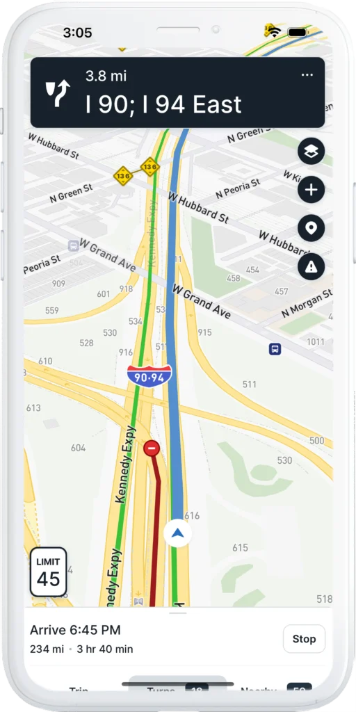
TruckMap app interface

TruckMap lets you enter custom vehicle dimensions for truck-safe routing. Free on iOS and Android.

What TruckMap does not do for RVers: It does not include campground access instructions, RV-specific points of interest (dump stations, potable water), propane tunnel restrictions specific to recreational vehicles, or scenic route suitability assessments. The app’s database is commercial-trucker-focused: truck stops, weigh stations, diesel fuel, and load boards.

RV use case: Run your planned route through TruckMap before you leave. If TruckMap flags a clearance or restriction issue that Google Maps missed, reroute. If TruckMap and Google Maps agree on the route, you have a higher confidence level that the road is safe for your rig.

Platforms: iOS (App Store) and Android (Google Play).

Best Free Pre-Trip Tool: TruckRouter.com

TruckRouter.com is a free web-based truck routing tool as of May 2026. It is better for desktop trip planning than live in-cab navigation. Registration is free and takes less than a minute.

TruckRouter provides truck-specific routes with data on:

  • Weight, height, width, and length restrictions along the planned route
  • Low clearance warnings for bridges and overpasses
  • Truck warnings for road segments with known hazards
  • Toll costs and toll road identification
  • Truck stop locations along the route
  • Route elevation data showing grade changes
  • State mileage reports with Excel export

RV use case: Before a travel day, enter your route into TruckRouter from a laptop. Review the restriction flags and elevation data. If the route shows a low clearance bridge or a steep grade you did not expect, adjust before you are behind the wheel. Print or screenshot the route summary as a backup reference.

Limitation: TruckRouter.com does not have a mobile app. It is a desktop-only planning tool. You cannot use it for live turn-by-turn navigation on the road.

The core question this guide answers: Can RVers use free truck GPS apps to avoid low bridges and restricted roads? Yes, as a secondary safety check. TruckMap provides live turn-by-turn truck routing with custom vehicle profiles. TruckRouter.com provides desktop-based pre-trip planning with restriction data. Neither replaces campground arrival instructions, posted road signs, or an RV-specific GPS for drivers who want a single integrated solution.

Where Free Truck GPS Falls Short for RVers

Free truck GPS tools solve part of the safe-routing problem. They do not solve all of it. The gap between “truck safe” and “RV safe” is real, and pretending otherwise puts your rig at risk.

Free truck routing tools typically do not account for:

  • Campground entrance roads with tight turns, low tree branches, or unpaved surfaces
  • RV park access instructions that specify a particular entrance or approach direction
  • Propane rules by tunnel or bridge that apply to recreational vehicles but not to all commercial trucks
  • Scenic road suitability for large or heavy RVs
  • Tight campground turns that a semi truck would never attempt but an RVer might
  • Gravel and dirt road comfort for vehicles with low ground clearance or long wheelbases
  • Dump station and potable water locations that are RV-specific points of interest
  • Class B vs. Class A vs. fifth wheel differences in maneuverability and clearance needs

A truck GPS routes an 18-wheeler between loading docks. An RV GPS should route your rig between campsites. The data requirements are different, and free truck tools were not built with campground data in their systems.

This matters most on BLM and National Forest dispersed camping roads where access conditions change seasonally and posted signs may be the only reliable information available.

My Safer Routing Stack

After 35 years of RV travel and testing more navigation tools than I can count, this is the routing workflow I trust for free or low-cost trip planning:

Pre-Trip (Desktop or Laptop)

  1. Google Maps for general drive time, traffic patterns, and fuel stop identification.
  2. TruckRouter.com for a truck-route safety check on the same route. Review height, weight, and clearance flags. Compare against the Google Maps route.
  3. Campground arrival instructions. Read the campground or dispersed site’s specific approach directions. Many BLM sites and RV parks specify which road to use and which to avoid.

On the Road (Mobile)

  1. Google Maps for live navigation, traffic rerouting, and finding services.
  2. TruckMap as a live secondary check if you encounter an unfamiliar road or detour.
  3. State DOT signage and local posted signs. If an app says the road is fine but a posted sign says otherwise, trust the sign. Posted restrictions are legally enforceable. App data is advisory.

The non-negotiable rule: Never ignore a posted sign because an app says the road is fine. Posted bridge clearance signs, weight limit signs, and no-truck signs are placed there by the authority that owns the road. An app’s database may be outdated. The sign is current.

If you plan to boondock on public land, download offline maps while you still have Wi-Fi. Cell data limits make on-the-road downloads impractical, and dispersed camping areas are frequently in dead zones. Our RV internet setup guide covers dual-path connectivity for staying online in remote locations.

When a Paid RV GPS Tool Still Makes Sense

Free truck GPS apps fill a gap. They do not eliminate the need for a dedicated RV navigation solution for everyone. A paid RV GPS tool still makes sense for:

  • Big Class A motorhomes (35+ feet) where every turn and clearance matters
  • Tall fifth wheels with rooftop air conditioners pushing total height above 13 feet
  • Frequent mountain driving where grade warnings and descent alerts reduce brake fade risk
  • Long-distance trip planning across multiple states with varying restriction databases
  • RVers who want one integrated system combining safe routing, campground data, and dump station locations in a single interface
  • Anyone nervous about low bridges or restricted roads who wants maximum coverage rather than a patchwork of free tools

Paid RV GPS tools like RV LIFE, CoPilot GPS, and dedicated Garmin RV units include RV-specific databases that free truck apps do not have. The tradeoff is cost. The benefit is coverage. For high-risk rigs, the cost of a paid GPS subscription is small compared to the potential cost of a single bridge strike or wrong turn.

Bottom Line

Free truck GPS apps can help RVers avoid low bridges, weight-restricted roads, and truck-prohibited segments that Google Maps, Waze, and Apple Maps do not flag. TruckMap provides live truck-safe routing with custom vehicle profiles at no cost. TruckRouter.com adds free desktop pre-trip restriction checks with height, weight, and clearance data.

They are not a perfect replacement for an RV-specific GPS or dedicated trip planner. They do not know about campground access roads, propane tunnel restrictions, or RV-specific points of interest. Use them as a safety check layer in your routing workflow, not as a guarantee.

The safest approach combines free tools with common sense: check the route before you drive, verify with campground arrival instructions, and never override a posted sign because an app told you the road was clear.


Chuck Price

Chuck Price is the founder of Boondock or Bust and has over 35 years of RV travel experience, including extended boondocking across BLM and National Forest land in a 2018 Hymer Aktiv Class B motorhome. His GPS app testing methodology uses documented field routes with real-world hazards. Chuck has been featured on CBC Radio discussing RV boondocking. Learn more about Chuck.

Last updated: May 28,2026. App pricing and subscription models verified as of publication. Confirm current pricing directly with each app before downloading or purchasing.

Yosemite RV Trip Planning: No Reservations, Full Lots by 7:30 AM, and What to Do About It

Yosemite RV Trip Planning: No Reservations, Full Lots by 7:30 AM, and What to Do About It

Your current planning guide for Yosemite in 2026, updated with real-world conditions from the first weeks of the season: parking alerts, digital passes, towing enforcement, RV strategy, and transit backups.

By Chuck Price. Last updated: May 26, 2026 | Estimated read time: 10 minutes

Quick Reference

  • 2026 Entry Rule: No entrance reservation is required at any time of day.
  • Parking Reality: Lots have been filling by 7:30 AM on weekends and holidays. Tow trucks are active. Illegal parking has led to citations and vehicles towed from meadows and roadsides.
  • New: Digital Passes: Buy your entrance pass online at Recreation.gov up to two days before your visit. Download it to your phone. Skip the gate line.
  • New: Text Alerts: Text YNPTRAFFIC to 333111 for real-time parking and traffic alerts. Text YOSEMITE to 333111 for general park alerts.
  • You Still Need: The entrance fee ($35/vehicle for US residents; nonresidents pay an additional $100/person age 16+ at 11 designated parks including Yosemite), plus any campground, lodging, Half Dome, or wilderness permits tied to your trip. Verify current fees at NPS.
  • Best Backup Plan: Use YARTS from a gateway community to bypass the parking problem entirely.
  • Best Pre-Trip Check: NPS Current Conditions page the night before and the morning of your visit.
  • Golden Rule: Screenshot every reservation, permit, and map before you lose cell service.

May 2026 Update: What We Predicted Is Now Happening

When we published this guide in March 2026, we warned that dropping the entrance reservation would shift the problem from timed access to parking and congestion. That is exactly what has happened. Yosemite recorded its highest spring visitation in a decade. On the first major weekend in May, tow trucks cleared illegally parked vehicles from the Camp 4 overflow lot while the shuttle bus sat trapped behind them. A 1.8-mile line of cars parked illegally along the road between Camp 4 and El Cap Picnic Area. Social media filled with reports of 90-minute entry lines, overflowing lots, and trail congestion.

Both Yosemite and Sequoia National Parks posted warnings on social media about citations and towing for vehicles parked on roadsides, meadows, or in unmarked spots. Visitors reported parking lots full before 7:30 AM on peak days.

This guide has been updated with digital pass options, text-based parking alerts, towing and citation details, Tioga Road status, updated entrance fee details, and revised arrival timing based on observed conditions.

Hiker reading Yosemite entrance sign at sunrise with granite cliffs and sky
Yosemite in 2026 has no entrance reservation, but parking, traffic, and towing enforcement are the real planning constraints.

What Changed for 2026

In February 2026, Yosemite Superintendent Ray McPadden announced that the park would not use a timed-entry reservation system in 2026. The decision followed a Department of Interior directive to keep national parks open and accessible, and an NPS evaluation of 2025 traffic patterns.

The park entrance fee still applies. Yosemite now relies on active traffic management instead of timed-entry reservations. That includes real-time traffic monitoring, temporary traffic diversions when parking areas fill, and additional staffing at key intersections during peak periods.

What that means for you: Stop planning around a 6am-to-2pm entry window. That mental model is dead. In 2026, your biggest problems are parking, traffic backups, road conditions, towing enforcement, and limited cell service.

New for 2026: Digital Entrance Passes

Yosemite now offers digital entrance passes through Recreation.gov. You can purchase a single-visit pass up to two days before your trip and download it to your phone or digital wallet (Apple Wallet, Google Wallet). This lets you skip the payment step at the entrance gate and move through faster.

The America the Beautiful annual pass is $80 for US residents and $250 for nonresidents. Both versions cover entrance fees at all NPS sites for 12 months and are available as digital downloads through Recreation.gov. Verify current pricing at Recreation.gov before purchasing.

Buy Yosemite Digital Pass
Buy America the Beautiful Pass

New for 2026: Nonresident Entrance Fee

Beginning in 2026, nonresidents (non-US residents) pay an additional $100 per person (age 16 and older) on top of the standard $35 vehicle entrance fee. Children 15 and under are exempt. The nonresident America the Beautiful annual pass ($250) covers the passholder plus three additional passengers and is valid for 12 months. As of May 2026, this fee applies at Yosemite, Sequoia, Kings Canyon, and eight other designated national parks. Fee structures can change. Verify current rates at the NPS Yosemite fees page before your trip.

What You Actually Need to Plan for in 2026

Without an entrance reservation requirement, Yosemite planning gets simpler on paper but harder in practice. The first weeks of the 2026 season confirmed this. The park recorded its highest spring visitation in over a decade. Parking lots filled before mid-morning on weekends. NPS deployed tow trucks and issued citations for illegal parking on meadows and roadsides.

Your working checklist for 2026 should focus on six things:

  • Digital pass: Buy it before you leave home. It saves time at the gate.
  • Text alerts: Sign up for YNPTRAFFIC (text to 333111) before you lose cell service.
  • Road conditions: construction, chain controls, weather delays, and closures.
  • Parking strategy: Arrive before 7:30 AM on weekends/holidays. Have a backup lot in mind. Plan to park once and stay parked.
  • Backup transportation: YARTS from a gateway community, or the free in-park shuttle once parked.
  • Offline readiness: Screenshots of maps, permits, campground confirmations, and your digital pass before you lose service.

The Best 2026 Yosemite Arrival Strategy

Arrival Framework (Updated for 2026 Conditions)

  • If you want parking: Arrive before 7:30 AM on weekends and holidays. Lots have been filling by mid-morning even on weekdays during peak periods.
  • If you hate stress: Visit midweek. Avoid arriving between 10 AM and 2 PM on any day during peak season.
  • If you are driving a larger RV: Have a backup parking target before you enter the Valley. Your options disappear faster than they do for cars.
  • If you are flexible: Use YARTS from Mariposa, Oakhurst, Groveland, or another gateway community. You bypass the parking problem entirely.
  • If you are depending on chargers, specific trailhead parking, or oversized spaces: Plan conservatively and assume your first choice will be full.
  • Park once and stay parked: This is now official NPS guidance. Walk, bike, or shuttle from your parking spot for the rest of the day. Do not give up a spot to repark closer to your next destination.

Earlier Yosemite reservation years trained visitors to think in terms of entry windows. In 2026, replace that with a parking-first model. Your goal is not beating a reservation clock. Your goal is getting in before your preferred lot, shuttle stop, or activity becomes unavailable.

The 2026 season has proven this is not theoretical. On a Thursday before Memorial Day weekend, even visitors who found parking described themselves as lucky. On the preceding weekend, drivers circled lots for hours. Five separate strangers asked one visitor walking through Camp 4 if they were leaving their spot.

Real-Time Alerts: Text Before You Go

Sign Up for Yosemite Text Alerts

These are free NPS text alert services. Sign up before you lose cell service on the drive in.

  • Traffic and parking alerts: Text YNPTRAFFIC to 333111
  • General park alerts (emergencies, closures): Text YOSEMITE to 333111

You can also check go.nps.gov/ynptraffic for current conditions when you have service. Example alert: “South Entrance delay is currently about 1.5 hours.”

No text means parking is still technically available somewhere. It does not mean it is easy. If you start receiving alerts, adjust your plan immediately. Consider redirecting to Tuolumne Meadows, Wawona, Hetch Hetchy, or another area outside Yosemite Valley.

Road Conditions and Closure Checks

This is the most important live planning tool for your trip. Check it the night before, the morning you leave, and again whenever you regain service:

Real-Time Conditions

Use the official Yosemite conditions page for road closures, construction, weather issues, and operational alerts.

Tioga Road (Highway 120 East) opened May 15, 2026. Check current status before planning a Tioga Pass trip, as closures can occur due to weather or hazards.

For road status by phone: 209-372-0200 (then press 1, 1).

NPS Current Conditions
California Road Conditions

Do not rely on an old screenshot, a Facebook comment, or a generic travel blog once you are close to Yosemite. The conditions page is the source that matters.

RV, Parking, and Shuttle Reality

RVs can visit Yosemite, but your margin for error is smaller than ever in 2026. With no reservation system filtering demand, parking flexibility drops fast once the Valley gets busy. Even standard vehicles have struggled to find spots this season. For RV travelers, early arrival, conservative expectations, and shuttle use are not just good ideas. They are requirements. For more on RV-specific logistics at national parks, see our boondocking beginner’s guide.

Practical RV Planning Rules (2026 Season)

  • Arrive before 7:30 AM on weekends and holidays. You need the extra time more than car visitors do.
  • Have at least two backup parking targets mapped before you enter the Valley.
  • Do not build your day around finding the perfect close-in space. It will not be there by mid-morning.
  • Park once. Use the free in-park shuttle to reach your destinations.
  • Do not park on meadows, roadsides, or in unmarked spots. Tow trucks have been active in 2026, and vehicles parked illegally have been cited and removed.
  • If your rig is large, review current maps and parking guidance before the trip and be ready to pivot.
  • Keep charging expectations modest. Do not assume an available charger will be waiting for you.

Towing, Citations, and Illegal Parking: What Is Actually Happening

This is new for 2026 and worth its own section. The elimination of the reservation system has led to a visible increase in illegal parking, and NPS is responding with enforcement.

In early May 2026, tow trucks were actively clearing vehicles from the Camp 4 overflow lot that had been parked at angles blocking the shuttle bus. A continuous line of cars parked illegally along the 1.8-mile stretch of road between Camp 4 and El Cap Picnic Area. Visitors reported being ticketed and towed for parking between trees, in ditches, and on protected meadows.

Both Yosemite and Sequoia National Parks posted warnings on Instagram urging visitors not to park in roadways or unmarked spots, citing safety risks, citations, and towing.

The takeaway: If you cannot find a legal spot, do not improvise. Move to another lot, use the shuttle from where you are, or leave the Valley and try a different part of the park. A towed vehicle ruins your trip far more than a longer walk from a farther lot.

The Best Alternative to Driving: YARTS

If your goal is reducing hassle, not just getting through the gate, YARTS is worth serious consideration. It reduces the need to deal with parking hunts, Valley congestion, and active traffic controls on the busiest days.

If your trip date is fixed and the Valley is likely to be crowded, the lowest-stress move may be leaving the car outside the park and riding YARTS in.

For travelers staying in gateway communities (Mariposa, Oakhurst, Groveland, El Portal, or Merced) or building a long day trip, YARTS bypasses the single biggest failure point: finding and keeping a parking spot in the Valley. If you are planning an extended road trip, see our guide to free camping apps for finding spots near gateway communities, and our RV overnight parking guide for places to stop on the drive in.

The shuttle system inside the Valley is also free, but it has been running at or beyond capacity on peak days in 2026. YARTS gets you into the park without needing to park at all.

YARTS Official Site

5 Costly Yosemite Mistakes in 2026

  1. Assuming the lack of a reservation means easy access. It does not. Yosemite recorded its highest spring visitation in a decade after dropping the reservation system. No reservation required is not the same as no congestion.
  2. Arriving after 8 AM on a weekend or holiday. Parking lots have been filling by 7:30 AM. If you arrive at 10 AM on a Saturday, expect to circle, get frustrated, or get redirected by traffic management.
  3. Parking illegally. Tow trucks are active. Vehicles have been towed from meadows, ditches, roadsides, and angles blocking shuttle routes. Citations are being issued. This is not a warning. It is what is already happening.
  4. Showing up without offline backups. Screenshot maps, permits, campground confirmations, your digital entrance pass, and key links before you lose service. Cell coverage inside the park is unreliable.
  5. Ignoring alternatives to the Valley. Tuolumne Meadows (Tioga Road opened May 15), Wawona, and Hetch Hetchy offer quality experiences with less congestion. NPS is actively encouraging visitors to explore these areas.

Historical Context: Why Older Yosemite Advice Still Confuses People

Older Yosemite guides often talk about 6am-to-2pm reservation windows, late-May releases, and timed-entry booking fees. That was relevant in prior reservation seasons (2020 through 2025, with variations). It is not the current 2026 rule.

The reservation system was originally introduced during COVID-19 in 2020 to limit capacity. Over time it evolved into a congestion management tool. In April 2025, Interior Secretary Doug Burgum ordered national parks to remain open and accessible. In February 2026, Superintendent McPadden announced the system would not be used for the 2026 season.

A March 2026 survey by the Yosemite Union found that approximately 85% of 135 verified employee responses disapproved of the decision, and more than 300 staff members have publicly called for it to be reversed. The early-season results have added weight to those concerns.

That is why Yosemite planning content keeps going stale. The details that used to matter most are no longer the live constraint. In 2026, parking, road conditions, towing enforcement, and operational changes are the practical bottlenecks.

Frequently Asked Questions

Do you need a reservation to enter Yosemite in 2026?

No. Yosemite is not requiring an entrance reservation in 2026. The standard park entrance fee still applies. However, parking lots have been filling by 7:30 AM on weekends and holidays.

How do I get real-time Yosemite parking and traffic alerts?

Text YNPTRAFFIC to 333111 for traffic and parking alerts. Text YOSEMITE to 333111 for general park alerts including emergencies. Sign up before you lose cell service on the drive in.

Can I buy my Yosemite entrance pass online?

Yes. Yosemite now offers digital entrance passes through Recreation.gov. You can purchase a single-visit pass up to two days before your trip and download it to your phone or digital wallet. This reduces wait time at entrance gates.

What time do Yosemite parking lots fill up?

During the 2026 season, parking lots in Yosemite Valley have been filling by 7:30 AM on weekends and holidays. Midweek lots generally have more availability but can still fill by mid-morning during peak periods. Text YNPTRAFFIC to 333111 for real-time updates.

Can I enter Yosemite after 2 pm without a reservation?

Yes. In 2026, Yosemite is not requiring an entrance reservation at any time of day. However, arriving in the afternoon means parking is likely full in the Valley. Plan to use the shuttle, YARTS, or visit areas outside the Valley.

How much does it cost to enter Yosemite in 2026?

The standard vehicle entrance fee for US residents is $35, valid for seven consecutive days. Beginning in 2026, nonresidents (non-US residents) pay an additional $100 per person (age 16 and older) at 11 designated parks including Yosemite. Fee structures can change. Verify current rates at the NPS Yosemite fees page. Digital passes and America the Beautiful annual passes are available through Recreation.gov.

What if I have a Half Dome permit or campground reservation?

Those are still separate reservations or permits for the activity itself. They matter for your trip, but they are not replacing an entrance reservation because Yosemite is not using an entrance reservation system in 2026.

Is Tioga Road open in 2026?

Tioga Road (Highway 120 East) opened to vehicles on May 15, 2026. Check the NPS Current Conditions page or call 209-372-0200 for real-time status, as closures can occur due to weather or hazards.

Will I get towed for illegal parking in Yosemite?

Yes. In May 2026, NPS actively towed vehicles parked illegally along roadsides, on meadows, and in unmarked spots. Both Yosemite and Sequoia National Parks posted social media warnings about citations and towing. Do not park outside designated areas.

Is Hetch Hetchy included in the 2026 entry policy?

No entrance reservation is required for Hetch Hetchy or any other part of Yosemite in 2026. However, Hetch Hetchy still has its own operating hours and access details. Check current park guidance before visiting.

Official Links to Bookmark

These are the pages that should drive your final planning decisions:

NPS Entrance Information
Road Conditions & Closures
Recreation.gov Yosemite
Buy Digital Entrance Pass
YARTS Bus System

Bottom line: Yosemite is easier to understand in 2026 because there is no entrance reservation requirement. It is harder to execute because the infrastructure cannot absorb unlimited demand. Plan around traffic, parking, towing enforcement, and backups. Arrive early or arrive differently. And download that digital pass before you leave home.

Best Apps for Finding Free Campsites: 2026 Full Guide

Best Apps for Finding Free Campsites: 2026 Full Guide

Finding free camping used to mean buying a laminated atlas and asking a stranger at a trailhead. Now you have a dozen apps, a handful of websites, and a Facebook thread telling you to try a Walmart parking lot. This guide cuts through all the options: apps, websites, and no-app overnight choices, so you can find your best options and confirm local rules before you park for the night.

It also covers something most free camping guides skip: what happens after you find a site. If you’re towing a large rig, getting there safely requires a navigation app that knows about low bridges and weight limits. Google Maps doesn’t. The navigation section later in this guide explains why, backed by 85 miles of field-test data.

Last updated: May 27, 2026. App pricing and policies verified as of publication. Confirm current pricing directly with each app before purchasing.

Which Free Camping App Should You Use First?

Start with the app that matches your situation tonight.

Use Case Best First App Backup App Why
Finding a free overnight stop tonight RVParky Google Maps Fastest for small-town overnight options and rest stops
Finding dispersed camping on public land Campendium The Dyrt Best for reviews, site notes, and public-land context
Checking remote off-grid spots iOverlander Gaia GPS Useful for remote pins, road notes, and user-submitted updates
Planning without cell service AllStays Gaia GPS Best when offline access matters
Checking old free campsite listings Freecampsites.net iOverlander Useful for research, but verify before driving
Pro tip: No single app covers everything. Most experienced RVers carry two or three: one for tonight’s stop, one for trip planning, and one that works offline. These apps find the site. For navigating a large rig safely to that site, see the navigation warning section later in this guide.

Free vs. Freemium: What You’re Actually Paying For

Most free camping apps are freemium, not free. The distinction matters when you’re on a budget or low on cell data. Here’s what the cost structure looks like across the tools covered in this guide. Pricing verified as of May 2026: confirm directly with each app before purchasing, as tiers and annual rates change.

App / Tool Cost Free Tier Limits Best Use Case
RVParky Free Full access, no paywall Overnight stops, small-town finds
Campendium Free / Pro (verify current pricing) Basic listings; Pro opens filter access Dispersed camping, user reviews
The Dyrt Free / $59.99/yr Pro Free sites locked behind Pro tier BLM/USFS boundary mapping
iOverlander Free (app + web) App limits to one state; web version has no limits Off-grid, international travel
Freecampsites.net Free Full access Quick pre-trip research from desktop
KampTrail Free Full access Verified federal campsites only
AllStays $34.99/yr (subscription) Limited free tier; full offline access requires subscription No-signal situations, dump stations
Gaia GPS $59/yr Free tier limited; layer stacking requires paid Topo mapping, road-open verification
Bottom line: If you want zero-cost, full-access tools, use RVParky, iOverlander (web version), Freecampsites.net, and KampTrail. The Dyrt and Campendium are worth paying for if you camp more than a few nights a year on dispersed land.

RVParky: The Community’s Most Recommended Free Camping App

RVParky is free, with no subscription and no paywall. It covers campgrounds, overnight parking spots, dump stations, and rest areas: all in one map. In RV forums and Facebook groups, it comes up more often than any other free app when people ask about overnight stops, especially in small towns where other apps come up empty.

The app runs on user-submitted and verified location data. It’s particularly strong for the kind of stops that don’t show up in recreation databases: city parks with overnight parking, fairgrounds, and municipal lots. One useful workflow is to pull up RVParky first when approaching an unfamiliar town late in the day, check what’s within 10 miles, then confirm with a quick call before committing.

RVParky quick facts:

  • Cost: Free, no subscription
  • Platform: iOS and Android
  • Website: rvparky.com
  • Covers: Campgrounds, free overnight spots, dump stations, rest areas
  • Best for: En-route overnight stops, small-town finds, non-campground options
  • Limitation: User-generated data; verify availability before arriving

RVParky doesn’t have the BLM boundary overlays of The Dyrt or the topographic detail of Gaia GPS. It’s not built for planning a week of dispersed camping on public land. It’s built for tonight: and it delivers.

Campendium: Best for Dispersed Camping Reviews

Campendium app interface showing free dispersed camping listings and user reviews

Campendium built its reputation on user-generated reviews of free dispersed camping on Bureau of Land Management (BLM) and National Forest land. The free tier gives you access to the listings. The Pro tier (now part of the Roadpass Pro bundle) adds filtering by site type, hookups, price, and cell signal. Verify current Pro pricing at campendium.com, as tiers have changed since Campendium was acquired by Roadtrippers.

The platform’s strength is also its limitation: it’s only as current as the people contributing to it. Reviews go stale. A listing that showed a lakeside spot three years ago may not mention the lake dried up in 2019. Cross-check recent reviews before driving an hour off route.

Campendium works best as a research tool before a trip, not a last-minute solution on the road. Use it to identify candidate spots in an area, read recent reviews, then confirm on a topo map before committing. If you plan to camp on BLM land, make sure you understand the current BLM camping rules before you set up.

Campendium quick facts:

  • Cost: Free basic / Pro via Roadpass Pro subscription (verify at campendium.com)
  • Platform: iOS, Android, web
  • Best for: Dispersed camping research, reading detailed user reviews
  • Limitation: User-generated; older reviews may be inaccurate
  • Pro enables: Filters by price, hookups, cell signal, site type

The Dyrt: Best for Public Land Boundary Mapping

The Dyrt app showing BLM and National Forest boundary map layers for free camping

The Dyrt’s free version is solid for browsing established campgrounds. The reason to pay for Pro ($59.99/year) is the map layers: toggle on BLM and USFS (U.S. Forest Service) boundary overlays and you can see exactly which land is open for dispersed camping before you pull off the road.

The practical value: you’re in Colorado, surrounded by “Private Property” signs, and you don’t know where the public land starts. Pull up The Dyrt Pro, flip on the USFS layer, and the boundary lines appear on the map. That’s not a convenience feature: it’s what keeps you from camping illegally on someone’s ranch.

Filter immediately for “Free” and “Pets Allowed” (if applicable) to avoid scrolling through 40 paid options. The data volume is the app’s main friction point; the filters are what make it usable in the field.

The Dyrt quick facts:

  • Cost: Free basic / $59.99/yr Pro
  • Platform: iOS, Android, web
  • Best for: Confirming legal access to dispersed camping areas
  • Key feature: BLM and USFS boundary map overlays (Pro only)
  • Limitation: Filtering required; free-site search locked behind Pro

iOverlander: Best for Off-Grid and International Travel

iOverlander app showing off-grid camping spots and pull-offs across North America and Canada

iOverlander is free on both the app and the web: but there’s a meaningful difference between them. The mobile app has historically limited free users to one state at a time (verify current free-tier limits in the app, as this may change). The web version at ioverlander.com gives you the full world map with no restrictions and no subscription. If you’re planning routes from a laptop, use the website. Save the app for in-field lookups when you need mobile access.

The listings include established campgrounds, random pull-offs, rest areas, and anything else a contributor has documented: domestically and internationally. It’s the go-to for Canada and Mexico travel where U.S.-centric apps fall short.

Data freshness is the known issue. Listings aren’t always current. A “quiet rest area” on the map may now be a truck stop running engines all night. Treat iOverlander as a lead generator, not a guarantee: and read the most recent comments on any listing before committing.

iOverlander quick facts:

  • Cost: Free (app + web)
  • Platform: iOS, Android, web (ioverlander.com)
  • Best for: Off-grid travel, international routes (Canada, Mexico)
  • Key tip: Use the website for full world map; app limits to one state free
  • Limitation: Listings are user-generated and not always current

iOverlander vs The Dyrt: Which Is Better for Free Camping?

This is one of the most common questions in RV forums, and the answer depends on what you’re trying to do.

iOverlander is the stronger choice for off-grid and international travel. Its world map coverage is unmatched, and the web version is completely free with no state restrictions. The Dyrt is the stronger choice for confirming legal access to dispersed camping areas in the U.S. Its BLM and USFS boundary overlays answer the question that iOverlander can’t: is this actually public land?

Where iOverlander wins: international coverage (Canada, Mexico, Central America), completely free web access, no subscription required for full functionality on desktop.

Where The Dyrt wins: public land boundary verification, structured campground reviews with photos, offline map downloads (Pro), and integration with campground booking.

If you only camp domestically on public land, The Dyrt Pro ($59.99/year) gives you more decision-critical information. If you travel internationally or want a zero-cost option, iOverlander’s web version is the better starting point. Many RVers use both: The Dyrt for boundary verification and iOverlander for obscure pull-offs and water sources that The Dyrt doesn’t list.

Freecampsites.net: The Web-Based Option Worth Bookmarking

Freecampsites.net is not an app: it’s a website, and that’s not a knock against it. For pre-trip research from a desktop or tablet, it’s one of the cleaner tools available. The site aggregates free and low-cost camping locations across the U.S. with user reviews, photos, and GPS coordinates. No account required to search. No paywall.

The data skews toward established dispersed spots on BLM, National Forest, and state land. It doesn’t cover the same range of urban overnight stops that RVParky does. Use both: Freecampsites.net for trip planning where you know you’ll be on public land, RVParky for en-route stops in unfamiliar towns.

Freecampsites.net quick facts:

  • Cost: Free
  • Platform: Web (freecampsites.net)
  • Best for: Desktop trip planning, BLM and National Forest spots
  • Limitation: Web-only; limited urban/overnight parking coverage

KampTrail: Verified Federal Data, No Subscription

KampTrail app interface showing verified federal campsites sourced from Recreation.gov RIDB API

Full disclosure: I built KampTrail. After 35 years of RVing, I got tired of apps sending me to coordinates that landed in the middle of a lake or listed campsites that had been closed for two seasons. So I went to the primary source.

KampTrail pulls directly from the Recreation.gov RIDB API: the federal government’s own campsite database. Based on the RIDB API data pull used at publication (March 2026), the app indexed approximately 4,400 federal campsites and 2,700 water stations. These counts reflect what was in the federal database at that time and will change as the RIDB is updated.

What it doesn’t do: cover the full range of dispersed camping options, user-reviewed spots, or overnight parking in commercial locations. KampTrail is purpose-built for federal land accuracy. It’s the right tool when you need to know exactly what’s on BLM or National Forest land, not what someone thought was there in 2022.

KampTrail quick facts:

  • Cost: Free
  • Data source: Recreation.gov RIDB API (federal government)
  • Best for: Verified federal campsite locations, water station mapping
  • Includes: Cell tower overlays, water station locations
  • Limitation: Federal sites only; no dispersed camping or commercial overnight coverage

AllStays Camp & RV: One-Time Purchase, Full Offline Access

AllStays Camp and RV app showing campground listings, dump stations, and truck stops

AllStays moved to a subscription model in 2022 after being sold to new ownership. As of May 2026, pricing is $34.99/year (with monthly and quarterly options also available). Verify current pricing at allstays.com or in your app store. The app downloads the full database to your device, so it works offline: which matters when you’re 40 miles from cell service and need to find a dump station or a county park that doesn’t show up in Google. For a deeper look at everything AllStays covers, see our full AllStays Camp and RV review.

The interface is dated. The reviews aren’t as fresh as The Dyrt’s. But for offline reliability and breadth of location types: campgrounds, dump stations, truck stops, rest areas, Walmarts: nothing else in this list matches AllStays for sheer variety of stop types in a single app.

AllStays quick facts:

  • Cost: $34.99/yr subscription (verify current pricing at allstays.com)
  • Platform: iOS and Android
  • Best for: No-signal situations, dump station finding, broad location types
  • Key feature: Full offline access after download
  • Limitation: Older interface; reviews less current than The Dyrt

Gaia GPS: For Serious Land Navigation

Gaia GPS app showing stacked topographic, BLM, and USFS Motor Vehicle Use Map layers

Gaia GPS ($59/year as of May 2026; verify current pricing at gaiagps.com) is not a campsite finder. It’s a mapping engine. If you open it expecting a list of spots to sleep, you’ll be frustrated. If you understand what it actually does, it’s the most powerful tool in this lineup for finding legal, unmapped dispersed camping.

The layer-stacking workflow is what sets it apart. Stack the Public Land layer (which land is open) on top of the USFS Motor Vehicle Use Map, or MVUM (which roads are open to vehicles) on top of satellite imagery (what the terrain actually looks like). That combination answers the three questions that matter for dispersed camping: Is this public land? Can I drive there? Is there a flat clearing for my rig?

Download offline maps before you leave cell range. Once you’re in the mountains, the cloud doesn’t exist.

Gaia GPS quick facts:

  • Cost: $59/year
  • Platform: iOS, Android, web
  • Best for: Experienced RVers finding unmapped dispersed spots, road-open verification
  • Key feature: Topo, BLM, and USFS MVUM layer stacking
  • Limitation: Steep learning curve; not a beginner tool

Best Free Camping App for BLM and National Forest Land

If your primary camping is on BLM or National Forest land, three tools cover different parts of the workflow.

For boundary verification, The Dyrt Pro ($59.99/year) is the most practical option. Its BLM and USFS boundary overlays show exactly where public land starts and private land ends. That’s the question that matters most when you’re pulling off a dirt road in the West.

For verified campsite data on federal land, KampTrail pulls directly from the Recreation.gov RIDB API. It won’t show you user-reviewed dispersed spots, but every listing it does show is sourced from the government’s own database.

For detailed terrain assessment and road-open verification, Gaia GPS ($59/year) is the power tool. Stack the MVUM layer on top of public land boundaries and satellite imagery, and you can evaluate a potential site without driving to it first.

Campendium fills the gap between these tools with user-submitted reviews of specific dispersed spots on public land. Use it to read firsthand accounts of access roads, site conditions, and cell signal before committing to a location. Before you head out to BLM land anywhere in the West, review the latest BLM dispersed camping rules to make sure your stay is compliant.

Best Free Camping App When You Have No Cell Signal

If you camp where cell service drops to zero, only two tools in this guide work reliably offline.

AllStays ($34.99/year) downloads its entire database to your device. Once cached, you have access to campgrounds, dump stations, truck stops, rest areas, and more with no connection required.

Gaia GPS ($59/year) lets you download full topographic and satellite map tiles for offline use. Pre-download the region you’re heading to before you leave cell range. Once you’re off-grid, you can still stack layers, check terrain, and navigate roads without any data connection.

The Dyrt Pro also offers offline map downloads, but its offline functionality is more limited than AllStays or Gaia GPS for deep backcountry use.

Why Free GPS Navigation Apps Don’t Work for Large RVs

The apps above find dispersed campsites. Getting your rig there safely is a separate problem, and free apps do not solve it.

In September 2025, I ran four navigation apps through an 85-mile test route in Oregon’s Deschutes National Forest. The route included five documented hazards: a 12’0″ clearance bridge, a 10-ton weight-limited road, a 3-mile washboard gravel stretch, a 2-mile dead zone with zero cell service, and a 9% grade descent with no guardrails. I tested each app with identical rig dimensions: 13’4″ height, 52 feet total length (34-foot fifth-wheel + 18-foot RAM 2500), 18,000 pounds combined weight.

Google Maps was the only app in the test that is still free as of this writing, and it scored 0.5 out of 5. It routed directly over the low bridge with no warning. It ignored the weight limit. It displayed no grade information. It chose the gravel shortcut over paved alternatives. Google Maps has no database of bridge clearances, weight restrictions, or road surfaces. It was designed for passenger cars. For a large RV on dispersed camping terrain, it is a damage-prevention failure.

App Cost/Year 12’0″ Bridge Weight Limit Offline Grade Warning Score
Hammer GPS $49.99 Pass Pass Partial Pass 4.5/5
CoPilot GPS Varies Pass Pass Pass Partial 4.5/5
RV LIFE Pro $65.00 Pass* Pass* Fail Pass* 3.5/5
Google Maps Free Fail Fail Partial Fail 0.5/5

* RV LIFE scores require the $65.00/year subscription. All pricing as of May 2026. CoPilot pricing varies; verify at copilotgps.com. Hammer GPS was free during my September 2025 test but moved to a paid model in late 2025. Scoring: Pass = 1 point, Partial = 0.5 points, Fail = 0 points across five hazard criteria. RV LIFE received a 0.5-point deduction for its paywall dependency on three passing scores. This was an in-house field test conducted in Deschutes National Forest, Oregon, using a 52-foot combined rig.

The only app that scored well and was free at the time of testing, Hammer GPS, moved to a paid subscription ($49.99/year) in late 2025. Based on my testing and research, no free navigation app currently available reliably handles bridge clearances, weight limits, and grade warnings for large rigs. TruckMap is a free trucker app that claims dimension-based routing, but user reviews consistently report accuracy problems on restricted routes, and I have not field-tested it.

The bottom line on free RV navigation: Use the free apps in this guide to find your site. Use a paid navigation app (Hammer GPS, CoPilot GPS, or RV LIFE Pro) or a dedicated Garmin RV GPS ($400-$700 as of May 2026) to get there safely. Google Maps should only be used for finding fuel, food, and services along a route you’ve already verified in an RV-specific app. Enter your exact rig dimensions during setup and preview every route before driving.

Is FreeRoam Still Useful in 2026?

No. FreeRoam is no longer available. The service ceased operations and the app was removed from app stores. As of May 2026, the FreeRoam website is offline and the app no longer appears in the Apple App Store or Google Play Store. If you see it recommended in an older article or forum post, that information is outdated.

FreeRoam was popular for its clean interface and integrated trip-planning tools, but the service ceased operations and the app is no longer available for download. Any bookmarked links to FreeRoam will return dead pages.

KampTrail was built in part to fill the gap FreeRoam left, using verified federal campsite data from the Recreation.gov RIDB API instead of user-submitted listings. For the user-submitted coverage that FreeRoam also provided, Campendium and iOverlander are the closest alternatives still operating.

Beyond Apps: Free Overnight Parking Options That Don’t Require a Download

The best free camping isn’t always on a map. Experienced RVers know a short list of reliable overnight options that don’t require an app subscription: just common sense and a phone call before you pull in. These are the options that show up in every RV community discussion about free overnight parking.

Rule that applies to every option below: Policies change. Local ordinances override corporate policy. Always call ahead or ask on-site before assuming you’re welcome.

Cracker Barrel

Cracker Barrel has historically been one of the most commonly cited free overnight options among highway travelers, and many locations still accommodate self-contained RVs for a single night. That said, Cracker Barrel has not published a formal, company-wide overnight RV policy. Individual store managers make their own call, and local ordinances frequently override any informal accommodation. Call the specific location before you arrive. Don’t assume.

Love’s, Pilot, and Flying J Truck Stops

Truck stops are built for oversized vehicles, which makes them naturally suited for RVs. Love’s and Pilot/Flying J are widely reported by RVers to accept overnight parking, and their lots are sized for semis so slideouts are rarely a problem. Neither chain publishes a formal RV overnight policy, so actual availability varies by location and local ordinance. The practical upside is real: most locations have restrooms, showers, laundry, and a store. Not scenic, but functional and well-lit. Love’s has its own app with fuel discounts if you stop regularly.

Casinos

Many casinos: particularly tribal casinos: welcome RV overnight parking. Some charge a small fee; some offer free dry camping to draw foot traffic inside. A few have full hookup RV parks on-site. Call ahead: policies vary widely by property. Casino parking lots tend to be large, well-lit, and secure.

Fairgrounds

County and state fairgrounds often allow RV overnight parking during non-event periods, sometimes with electrical hookups, for a modest fee or free. Outside of fair season, these lots are empty and the management is often open to arrangements. Worth a call when you’re passing through rural areas.

Interstate Rest Areas

Rest areas are governed by federal highway policy, but overnight parking rules are set state by state. Some states explicitly allow it; others prohibit stays longer than a few hours. Check your route states in advance by searching for “your state’s rest area overnight parking rules” or checking your state’s Department of Transportation website directly. One practical note: rest area parking can be tight for large rigs with extended slideouts: factor that into your approach before you commit to pulling in at night.

Walmart

Some Walmart locations allow overnight RV parking, but availability depends on the individual store and local ordinances. Don’t assume: confirm with the store manager when you arrive. For a state-by-state breakdown of what to expect, see our Walmart overnight RV parking guide.

Harvest Hosts

Harvest Hosts is a paid alternative, not a free campsite app. Members arrange overnight stays at wineries, breweries, farms, and attractions. Classic lists at $99 per year; the BOONDOCK20 offer link displayed $79.20 for the first year on September 29, 2026.

Save 20% on any Harvest Hosts plan with BOONDOCK20—new members, first year only. The link applies the code automatically. Check routes and rig eligibility before joining; host-support spending, optional fees, and the then-current renewal rate still matter. Boondock or Bust may earn a commission at no extra cost to you.

Decision Framework: Which Option Fits Your Situation

Not every camping situation calls for the same tool. Use this framework to match your situation to the right starting point.

Your Situation Start Here Why
Need a spot tonight, unfamiliar town RVParky Best coverage of non-campground overnight options
Planning dispersed camping trip next week Freecampsites.net + Campendium Best combination for desktop research with user reviews
Need to confirm that land is legally open to camp The Dyrt Pro BLM and USFS boundary overlays answer this directly
Traveling internationally or to Canada/Mexico iOverlander (web) Only tool in this list with strong international coverage
No cell signal, need offline backup AllStays + Gaia GPS (pre-downloaded) Both work fully offline once maps are cached
Want verified federal sites only, no guessing KampTrail or Recreation.gov Government-sourced data; no user-submitted inaccuracies
Driving a highway corridor overnight Cracker Barrel / Love’s / truck stops Consistent availability; no app needed, just call ahead
Want overnight stops with character (farms, wineries) Harvest Hosts Unique hosts, membership-based, ~$99/yr
Finding unmapped dispersed spots off-grid Gaia GPS Topo + MVUM layers find spots other apps don’t list
Navigating a large rig safely to a dispersed site Paid RV GPS app No free app handles bridge clearance and weight limits reliably

The Golden Rule of Free Camping

Free spots stay free only as long as the people using them treat them that way. That means packing out everything you packed in, keeping generator hours reasonable, and leaving the spot in better shape than you found it. The Leave No Trace principles aren’t just trail etiquette: they’re the reason these spots stay open.

The same applies to the non-campground options. Running a generator in a Cracker Barrel parking lot, popping slides out at a truck stop, or staying multiple nights somewhere that offered you one: these are the behaviors that get businesses to stop allowing RVs. Be a good guest, and the options stay open for everyone behind you.

Frequently Asked Questions

What is the best free app for finding free camping?

RVParky is the free camping app recommended most often in RV forums, with no subscription and broad coverage of campgrounds, overnight parking, and dump stations. Campendium and Freecampsites.net are strong complements for dispersed camping research.

Is Campendium free or does it cost money?

Campendium has a free tier that provides access to basic listings. The Pro tier (now part of Roadpass Pro) opens filter access for site type, hookups, cell signal strength, and price. Verify current pricing at campendium.com, as tiers have changed since Campendium was acquired by Roadtrippers.

Can I use iOverlander for free?

Yes. iOverlander is free on both the app and the web. The key distinction: the mobile app limits free users to one state at a time. The web version at ioverlander.com gives full world map access with no account required and no subscription.

Do Cracker Barrel locations still allow overnight RV parking?

Cracker Barrel does not publish a formal company-wide RV overnight policy. Many locations have historically accommodated self-contained RVs for a single night, but individual store managers decide, and local ordinances can override them. Call the specific location before you arrive to confirm.

What is the difference between The Dyrt free and The Dyrt Pro?

The Dyrt’s free tier covers established campground listings. Pro ($59.99/year) enables the free-site filter and: most importantly: BLM and USFS public land boundary overlays. Those map layers are the primary reason to pay for Pro; they let you confirm legal access to dispersed camping areas before you pull off the road.

Does Walmart still allow RV overnight parking?

Walmart does not publish a formal company-wide overnight RV parking policy. Some locations allow it; many do not. Availability depends on the individual store manager and local ordinances. Confirm with the store manager when you arrive. For state-specific details, see our Walmart overnight RV parking guide.

Is there a free GPS navigation app that’s safe for large RVs?

Not as of mid-2026. Google Maps has no bridge clearance or weight limit data and is not safe for large rigs. Hammer GPS, which was free when we field-tested it in September 2025, now requires a $49.99/year subscription. TruckMap is free and claims dimension-based routing, but user reviews report accuracy problems on restricted routes. For safe RV navigation, use a paid app like Hammer GPS, CoPilot GPS, or RV LIFE Pro, or a dedicated Garmin RV GPS device. Use the free apps in this guide to find your campsite, and a paid navigation tool to get there. Our roundup of RV-safe GPS routing apps covers free options first.

What happened to FreeRoam app?

FreeRoam is no longer available. The service shut down and the app was removed from app stores. KampTrail was built in part to fill that gap, using verified federal campsite data from the Recreation.gov RIDB API rather than user-submitted content. It’s free, and the campsite and water station counts update as the federal database updates.

{
“@context”: “https://schema.org”,
“@graph”: [
{
“@type”: “Article”,
“headline”: “Best Apps for Finding Free Campsites in 2026”,
“description”: “Compare free camping apps for RVers, including iOverlander, The Dyrt, Campendium, RVParky, AllStays, and Freecampsites.net. Includes field-test data on why free GPS navigation apps fail for large RVs.”,
“author”: {
“@type”: “Person”,
“name”: “Chuck Price”,
“url”: “https://boondockorbust.com/about/”
},
“publisher”: {
“@type”: “Organization”,
“name”: “Boondock or Bust”,
“url”: “https://boondockorbust.com”
},
“datePublished”: “2024-12-01”,
“dateModified”: “2026-05-27”,
“url”: “https://boondockorbust.com/boondocking-guide/the-best-apps-for-finding-free-campsites/”
},
{
“@type”: “FAQPage”,
“mainEntity”: [
{
“@type”: “Question”,
“name”: “What is the best free app for finding free camping?”,
“acceptedAnswer”: {
“@type”: “Answer”,
“text”: “RVParky is the free camping app recommended most often in RV forums, with no subscription and broad coverage of campgrounds, overnight parking, and dump stations. Campendium and Freecampsites.net are strong complements for dispersed camping research.”
}
},
{
“@type”: “Question”,
“name”: “Is Campendium free or does it cost money?”,
“acceptedAnswer”: {
“@type”: “Answer”,
“text”: “Campendium has a free tier that provides access to basic listings. The Pro tier, now part of Roadpass Pro, opens filter access for site type, hookups, cell signal strength, and price. Verify current pricing at campendium.com.”
}
},
{
“@type”: “Question”,
“name”: “Can I use iOverlander for free?”,
“acceptedAnswer”: {
“@type”: “Answer”,
“text”: “Yes. iOverlander is free on both the app and the web. The mobile app limits free users to one state at a time. The web version at ioverlander.com gives full world map access with no account required.”
}
},
{
“@type”: “Question”,
“name”: “iOverlander vs The Dyrt: Which is better for free camping?”,
“acceptedAnswer”: {
“@type”: “Answer”,
“text”: “iOverlander is better for international and off-grid travel with its free world map on the web. The Dyrt Pro is better for confirming legal access to U.S. public land with BLM and USFS boundary overlays. Many RVers use both.”
}
},
{
“@type”: “Question”,
“name”: “Is there a free GPS navigation app that’s safe for large RVs?”,
“acceptedAnswer”: {
“@type”: “Answer”,
“text”: “Not as of mid-2026. Google Maps has no bridge clearance or weight limit data. Hammer GPS moved to a paid model in late 2025. For safe RV navigation to dispersed campsites, use a paid app like Hammer GPS ($49.99/year), CoPilot GPS, or RV LIFE Pro ($65/year), or a dedicated Garmin RV GPS device.”
}
},
{
“@type”: “Question”,
“name”: “Is FreeRoam still available in 2026?”,
“acceptedAnswer”: {
“@type”: “Answer”,
“text”: “No. FreeRoam is no longer available and the app was removed from app stores. KampTrail and Campendium are the closest alternatives.”
}
},
{
“@type”: “Question”,
“name”: “What is the best free camping app for BLM land?”,
“acceptedAnswer”: {
“@type”: “Answer”,
“text”: “The Dyrt Pro ($59.99/year) offers BLM and USFS boundary overlays for verifying legal access. KampTrail provides verified federal campsite data from the Recreation.gov RIDB API. Campendium adds user reviews of specific dispersed spots on public land.”
}
},
{
“@type”: “Question”,
“name”: “What is the best free camping app with no cell signal?”,
“acceptedAnswer”: {
“@type”: “Answer”,
“text”: “AllStays ($34.99/year subscription) downloads its full database for offline use. Gaia GPS ($59/year) allows offline topographic and satellite map downloads. Both work fully without cell service once maps are cached.”
}
},
{
“@type”: “Question”,
“name”: “Does Walmart still allow RV overnight parking?”,
“acceptedAnswer”: {
“@type”: “Answer”,
“text”: “Walmart does not publish a formal company-wide overnight RV parking policy. Some locations allow it; many do not. Availability depends on the individual store manager and local ordinances. Always confirm with the store manager when you arrive.”
}
},
{
“@type”: “Question”,
“name”: “What happened to FreeRoam app?”,
“acceptedAnswer”: {
“@type”: “Answer”,
“text”: “FreeRoam is no longer available. KampTrail was built to fill that gap using verified federal campsite data from the Recreation.gov RIDB API. It’s free, and campsite and water station counts update as the federal database updates.”
}
}
]
},
{
“@type”: “ItemList”,
“name”: “Best Free Camping Apps 2026”,
“description”: “Top-rated apps and tools for finding free campsites, overnight parking, and dispersed camping in 2026.”,
“itemListElement”: [
{“@type”: “ListItem”, “position”: 1, “name”: “RVParky”, “url”: “https://www.rvparky.com”},
{“@type”: “ListItem”, “position”: 2, “name”: “Campendium”, “url”: “https://www.campendium.com”},
{“@type”: “ListItem”, “position”: 3, “name”: “The Dyrt”, “url”: “https://thedyrt.com”},
{“@type”: “ListItem”, “position”: 4, “name”: “iOverlander”, “url”: “https://www.ioverlander.com”},
{“@type”: “ListItem”, “position”: 5, “name”: “Freecampsites.net”, “url”: “https://freecampsites.net”},
{“@type”: “ListItem”, “position”: 6, “name”: “KampTrail”, “url”: “https://prowebpromo.github.io/kamptrail/”},
{“@type”: “ListItem”, “position”: 7, “name”: “AllStays Camp & RV”, “url”: “https://www.allstays.com”},
{“@type”: “ListItem”, “position”: 8, “name”: “Gaia GPS”, “url”: “https://www.gaiagps.com”}
]
}
]
}