Quick Answer
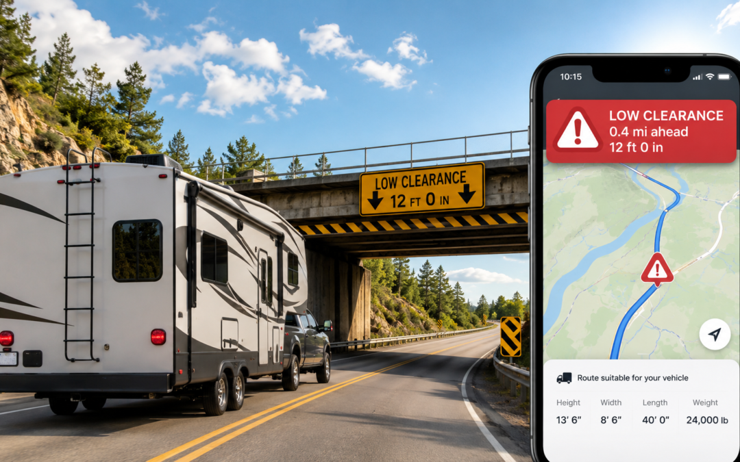
Free truck GPS apps like TruckMap can help RVers check routes for low bridges, weight limits, and restricted roads. TruckRouter.com adds free desktop pre-trip planning with height, weight, and clearance restriction data. Both are useful as secondary safety checks, not as dedicated RV GPS replacements. Truck-routing tools are built for commercial 18-wheelers and do not account for campground access roads, propane restrictions, or RV-specific points of interest. Use them alongside Google Maps and campground arrival instructions, not instead of either.
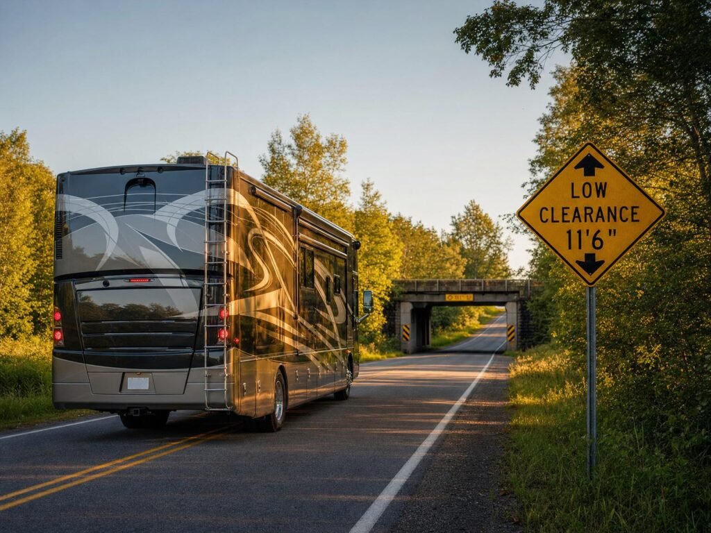
If you drive a Class A motorhome, a tall fifth wheel, or anything over 10 feet tall, Google Maps has a blind spot that matters. It does not know your vehicle height, length, weight, or propane status. It cannot warn you about a low bridge until you are staring at it through your windshield.
That is not speculation. The U.S. government’s own GPS.gov website confirms it: consumer GPS apps generally do not warn drivers of restricted roads, low bridges, or other information relevant to commercial motor vehicles (GPS.gov, Truck Traffic Routing). The FMCSA has warned that using non-commercial GPS devices in large vehicles contributes to preventable bridge strikes and has issued guidance urging commercial vehicle operators to use navigation systems designed for their vehicle type (FMCSA, Bridge Strike FAQ).
So what can RVers do about it without paying for another subscription? Free truck-routing apps exist. Some of them are genuinely useful as backup planning tools. But most “free RV GPS” advice online is either outdated, subscription-gated, or not actually RV-specific. This guide explains where free truck GPS tools fit, where they fall short, and how to build a safer routing stack without pretending any single app is magic.
🔹 In This Guide
Why Google Maps Is Not Enough for Bigger RVs
Google Maps is excellent for drive time, traffic conditions, and finding gas stations. It is not designed for vehicles taller than a standard passenger car. Google Maps does not accept vehicle height, length, weight, or axle count as routing inputs. It cannot filter routes by bridge clearance, weight restriction, or propane prohibition.
As of May 2026, that limitation has no workaround. There is no paid upgrade that adds RV-specific routing to Google Maps. The app routes all vehicles identically, regardless of size.
For a passenger car, this is fine. For a 13-foot-tall fifth wheel or a 45-foot Class A motorhome, it creates real hazards:
- Low bridge clearances that Google does not flag until you are committed to the road
- Weight-restricted roads that may not support a loaded RV and tow vehicle
- Parkways and scenic routes that prohibit commercial vehicles and large RVs
- Narrow mountain switchbacks where turning radius matters
- Tunnel restrictions that prohibit vehicles carrying propane
The same limitation applies to Waze and Apple Maps. All three are consumer GPS tools designed for cars.
⚠️ Common Misconception
Myth: “Low bridge strikes only happen to semi trucks. RVers don’t need to worry about clearance routing.”
Why it persists: Most bridge strike reporting focuses on commercial trucking incidents, making it easy to assume the problem does not apply to recreational vehicles.
Reality: Industry safety reports estimate that roughly 15,000 bridge strikes occur annually in the United States, many involving vehicles relying on consumer-grade GPS that does not account for clearance restrictions (FMCSA, Bridge Strike Prevention). RV forums document bridge strikes involving Class A motorhomes, fifth wheels with rooftop air conditioners, and travel trailers with raised cargo carriers. Any vehicle over 10 feet tall is at risk on roads with restricted clearance.
What to do: Measure your RV height from ground to tallest point (including roof air conditioners, antennas, and cargo) and enter that dimension into any truck GPS app before routing. Never assume Google Maps or Waze will warn you about a clearance issue. They will not.
Can RVers Use Truck GPS Apps?
Yes, with limits. Free truck GPS apps can help RVers check routes for low clearances, weight restrictions, hazmat-restricted roads, and truck-forbidden segments. Several allow custom vehicle profiles where you enter height, weight, and length.
But truck routing and RV routing are not identical. The core difference: truck GPS apps are designed for commercial 18-wheelers running interstate freight corridors. They optimize for truck stops, weigh stations, diesel fuel, and Hours of Service compliance. RVers need campground access roads, propane-friendly tunnels, scenic routes suitable for large vehicles, and dump station locations.
A truck GPS app should flag a road with a 12-foot bridge clearance if the restriction is in its database. It will not tell you that the campground entrance has a hairpin turn your 42-foot rig cannot make.
The practical use case: treat a free truck GPS app as a secondary route safety check before you drive, not as your only navigation source.
| Tool | Cost | Best For | RV Limitation |
|---|---|---|---|
| TruckMap | Free | Live turn-by-turn truck routing with custom vehicle profiles | Built for commercial truckers, not RVers |
| TruckRouter.com | Free (web only) | Pre-trip desktop planning with height, weight, and width restrictions | No mobile app; desktop planning only |
| Google Maps | Free | Drive time, traffic, fuel, and general navigation | No vehicle dimension input; cannot warn about low bridges or weight limits |
Best Free Option: TruckMap
TruckMap is a free truck-routing app available on iOS and Android as of May 2026. It provides truck-optimized GPS routes with turn-by-turn navigation designed for commercial vehicles.
For RVers, the useful features include:
- Custom vehicle profiles where you enter height, weight, and length
- Low bridge avoidance based on clearance data
- Weight restriction routing that bypasses roads your vehicle cannot legally use
- Truck-restricted road avoidance that keeps you off parkways and residential streets not designed for large vehicles
- Hazmat routing that avoids tunnels and roads prohibiting hazardous materials (relevant if you carry propane, although commercial hazmat rules may be stricter than those for RVs with fixed propane tanks — verify propane restrictions with posted signage or local DOT rules)
TruckMap generates revenue through ads targeting truck drivers for fuel discounts and load board access. The navigation features are free with no subscription paywall for basic routing.
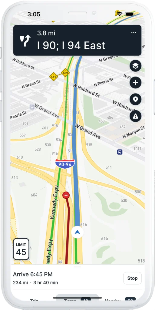
What TruckMap does not do for RVers: It does not include campground access instructions, RV-specific points of interest (dump stations, potable water), propane tunnel restrictions specific to recreational vehicles, or scenic route suitability assessments. The app’s database is commercial-trucker-focused: truck stops, weigh stations, diesel fuel, and load boards.
RV use case: Run your planned route through TruckMap before you leave. If TruckMap flags a clearance or restriction issue that Google Maps missed, reroute. If TruckMap and Google Maps agree on the route, you have a higher confidence level that the road is safe for your rig.
Platforms: iOS (App Store) and Android (Google Play).
Best Free Pre-Trip Tool: TruckRouter.com
TruckRouter.com is a free web-based truck routing tool as of May 2026. It is better for desktop trip planning than live in-cab navigation. Registration is free and takes less than a minute.
TruckRouter provides truck-specific routes with data on:
- Weight, height, width, and length restrictions along the planned route
- Low clearance warnings for bridges and overpasses
- Truck warnings for road segments with known hazards
- Toll costs and toll road identification
- Truck stop locations along the route
- Route elevation data showing grade changes
- State mileage reports with Excel export
RV use case: Before a travel day, enter your route into TruckRouter from a laptop. Review the restriction flags and elevation data. If the route shows a low clearance bridge or a steep grade you did not expect, adjust before you are behind the wheel. Print or screenshot the route summary as a backup reference.
Limitation: TruckRouter.com does not have a mobile app. It is a desktop-only planning tool. You cannot use it for live turn-by-turn navigation on the road.
The core question this guide answers: Can RVers use free truck GPS apps to avoid low bridges and restricted roads? Yes, as a secondary safety check. TruckMap provides live turn-by-turn truck routing with custom vehicle profiles. TruckRouter.com provides desktop-based pre-trip planning with restriction data. Neither replaces campground arrival instructions, posted road signs, or an RV-specific GPS for drivers who want a single integrated solution.
Where Free Truck GPS Falls Short for RVers
Free truck GPS tools solve part of the safe-routing problem. They do not solve all of it. The gap between “truck safe” and “RV safe” is real, and pretending otherwise puts your rig at risk.
Free truck routing tools typically do not account for:
- Campground entrance roads with tight turns, low tree branches, or unpaved surfaces
- RV park access instructions that specify a particular entrance or approach direction
- Propane rules by tunnel or bridge that apply to recreational vehicles but not to all commercial trucks
- Scenic road suitability for large or heavy RVs
- Tight campground turns that a semi truck would never attempt but an RVer might
- Gravel and dirt road comfort for vehicles with low ground clearance or long wheelbases
- Dump station and potable water locations that are RV-specific points of interest
- Class B vs. Class A vs. fifth wheel differences in maneuverability and clearance needs
A truck GPS routes an 18-wheeler between loading docks. An RV GPS should route your rig between campsites. The data requirements are different, and free truck tools were not built with campground data in their systems.
This matters most on BLM and National Forest dispersed camping roads where access conditions change seasonally and posted signs may be the only reliable information available.
My Safer Routing Stack
After 35 years of RV travel and testing more navigation tools than I can count, this is the routing workflow I trust for free or low-cost trip planning:
Pre-Trip (Desktop or Laptop)
- Google Maps for general drive time, traffic patterns, and fuel stop identification.
- TruckRouter.com for a truck-route safety check on the same route. Review height, weight, and clearance flags. Compare against the Google Maps route.
- Campground arrival instructions. Read the campground or dispersed site’s specific approach directions. Many BLM sites and RV parks specify which road to use and which to avoid.
On the Road (Mobile)
- Google Maps for live navigation, traffic rerouting, and finding services.
- TruckMap as a live secondary check if you encounter an unfamiliar road or detour.
- State DOT signage and local posted signs. If an app says the road is fine but a posted sign says otherwise, trust the sign. Posted restrictions are legally enforceable. App data is advisory.
The non-negotiable rule: Never ignore a posted sign because an app says the road is fine. Posted bridge clearance signs, weight limit signs, and no-truck signs are placed there by the authority that owns the road. An app’s database may be outdated. The sign is current.
If you plan to boondock on public land, download offline maps while you still have Wi-Fi. Cell data limits make on-the-road downloads impractical, and dispersed camping areas are frequently in dead zones. Our RV internet setup guide covers dual-path connectivity for staying online in remote locations.
When a Paid RV GPS Tool Still Makes Sense
Free truck GPS apps fill a gap. They do not eliminate the need for a dedicated RV navigation solution for everyone. A paid RV GPS tool still makes sense for:
- Big Class A motorhomes (35+ feet) where every turn and clearance matters
- Tall fifth wheels with rooftop air conditioners pushing total height above 13 feet
- Frequent mountain driving where grade warnings and descent alerts reduce brake fade risk
- Long-distance trip planning across multiple states with varying restriction databases
- RVers who want one integrated system combining safe routing, campground data, and dump station locations in a single interface
- Anyone nervous about low bridges or restricted roads who wants maximum coverage rather than a patchwork of free tools
Paid RV GPS tools like RV LIFE, CoPilot GPS, and dedicated Garmin RV units include RV-specific databases that free truck apps do not have. The tradeoff is cost. The benefit is coverage. For high-risk rigs, the cost of a paid GPS subscription is small compared to the potential cost of a single bridge strike or wrong turn.
Bottom Line
Free truck GPS apps can help RVers avoid low bridges, weight-restricted roads, and truck-prohibited segments that Google Maps, Waze, and Apple Maps do not flag. TruckMap provides live truck-safe routing with custom vehicle profiles at no cost. TruckRouter.com adds free desktop pre-trip restriction checks with height, weight, and clearance data.
They are not a perfect replacement for an RV-specific GPS or dedicated trip planner. They do not know about campground access roads, propane tunnel restrictions, or RV-specific points of interest. Use them as a safety check layer in your routing workflow, not as a guarantee.
The safest approach combines free tools with common sense: check the route before you drive, verify with campground arrival instructions, and never override a posted sign because an app told you the road was clear.
Chuck Price
Chuck Price is the founder of Boondock or Bust and has over 35 years of RV travel experience, including extended boondocking across BLM and National Forest land in a 2018 Hymer Aktiv Class B motorhome. His GPS app testing methodology uses documented field routes with real-world hazards. Chuck has been featured on CBC Radio discussing RV boondocking. Learn more about Chuck.
Last updated: May 28,2026. App pricing and subscription models verified as of publication. Confirm current pricing directly with each app before downloading or purchasing.


