New River Gorge National Park and Preserve, West Virginia, has rapidly transformed from a hidden gem to one of America’s most visited national parks. Logging a record-setting 1.71 million recreational visits in 2023, the park anticipates continued growth into 2025. This surge in popularity presents formidable logistics for travelers aiming to experience white-water rafting, the iconic Bridge Walk, and marquee hikes like the Endless Wall Trail. This comprehensive guide integrates crucial planning data—permit windows, shuttle timetables, and limited RV facilities—previously scattered across forums, into synchronized 1, 2, and 3-day itineraries designed to help you navigate the crowds and maximize your adventure.
Understanding New River Gorge’s Transformation
Designated a national park in 2020, New River Gorge recorded a 7.12% visitation increase in 2023 over 2022, making 2023 its highest-visitation year on record at that time. Peak congestion hits June through August, with over 200,000 visitors monthly. The Canyon Rim Visitor Center alone absorbed approximately 500,000 visitors, roughly 30% of the park’s total traffic. Economically, tourists to the three southern West Virginia parks (New River Gorge, Gauley River NRA, Bluestone NSR) spent $96.5 million in 2023, supporting 1,268 local jobs and yielding a cumulative $116.5 million economic benefit. Top spend categories include lodging (27%), restaurants (22%), fuel (17%), and groceries (14%), underscoring tourism’s vital role in the regional economy. This growth highlights the need for strategic planning to ensure a quality visitor experience.
Conquering Bridge Walk: Reservations & Tips
The iconic Bridge Walk offers a unique perspective from a catwalk 25 feet beneath the 3,030-foot span of the New River Gorge Bridge. Tours, operated by Bridge Walk LLC under a cooperative agreement with NPS and WV DOT, typically last 2-3 hours. To guarantee your spot and capture misty gorge photography, booking the earliest tour (often starting around 7:00 AM) is highly recommended. Arrive 30 minutes early at Bridge Walk HQ for gear fitting and a crucial safety briefing. Guides provide engaging commentary on the bridge’s engineering history and the surrounding area.
Requirements: Participants must be at least 8 years old, 48 inches (122 cm) or taller, have a waist circumference no greater than 53 inches, and have a thigh circumference no greater than 35 inches.
Cost: $79 per person; verify current operator pricing before booking.
Schedule: Tours are closed on Thanksgiving and Christmas. Limited full-moon/night tours are available in summer for a truly unique experience.
Logistics: Check-in at Bridge Walk HQ, shuttle to Canyon Rim Visitor Center, complete the full-length walk, then ascend a trail to meet your return shuttle. Remember to check their official site for specific requirements regarding prohibited items (e.g., loose belongings, food, open-toed shoes) to ensure a smooth check-in process.
New River Gorge offers diverse rafting experiences catering to different skill levels. The Upper New River (ages 6+) provides gentle Class I-II rapids, ideal for families and beginners. For experienced adventurers, the Lower New River Gorge (ages 12+) features iconic Class III-IV rapids, known for their thrilling drops and powerful currents. The main rafting season runs from June 1 to September 30, with high-water conditions in April-May offering an expert-level challenge. Commercial outfitters, such as ACE Adventure Resort and Adventures on the Gorge, provide comprehensive packages that typically include rafts, guides certified in CPR/First-Aid/Swift-Water Rescue, equipment (including wetsuits in shoulder seasons), and crucial shuttle services (e.g., from Cunard to Fayette Station). For independent paddlers, services like Hills to Hills Tours offer shuttles ($26.75 pp, $53.50 minimum). Be aware that high water levels (> 20k cfs) often necessitate reroutes from Cunard to McCreery. Always confirm specific trip details, meeting points, and water level conditions with your chosen outfitter or shuttle service.
RVs & Camping: Limitations & Solutions
Planning your visit with an RV requires careful consideration at New River Gorge. The park’s eight primitive campgrounds operate on a first-come, first-served basis, offering no hookups, water, or dump stations. Critically, these sites are not designed for large rigs; only four locations are suitable for small to medium-sized RVs. For larger RVs, or those seeking amenities, consider commercial RV parks located just outside the park boundaries, such as those offered by ACE Adventure Resort, which provide full hook-up sites. Trailhead parking is also a significant concern: Endless Wall, Kaymoor, and Long Point trailheads explicitly forbid medium and large RVs. Grandview, however, offers the most RV-friendly trail network within the park, featuring more accommodating parking. Plan your parking strategy in advance, especially during peak season, to avoid inconvenience and potential towing.
Dominating Endless Wall Trail: Parking & Safety
Voted USA Today’s “Best National Park Hike,” the 2.4-mile Endless Wall Trail is immensely popular. This popularity, however, leads to significant congestion. Parking lots at Fern Creek and Nuttall often fill before 10 AM, leading to illegal roadside parking that results in towing. While a larger lot beyond Nuttall eases some overflow, it does not fully solve the problem, particularly during peak summer weekends. To successfully hike this trail, plan to arrive very early (before 8 AM is ideal) or late afternoon. The hike to Diamond Point (1.2 miles one way) and back is the most common route, offering stunning views. The trail features narrow cliff-edge sections and active climbing routes and climbers below. Vigilance is crucial: stick to marked paths, do not approach cliff edges recklessly, and absolutely no rock tossing – climbers may be below.
Strategic Itineraries: 1, 2 & 3-Day Plans
These itineraries are designed to optimize your visit, integrating the park’s best experiences with logistical realities.
One-Day Express Itinerary
Ideal for visitors with limited time but a desire to hit the highlights.
Morning Bridge Walk Priority (07:00 – 10:00): Book the earliest tour to capture misty gorge photography and avoid later crowds. Arrive 30 minutes early for check-in and gear.
Mid-day Endless Wall Exploration (10:30 – 13:30): Drive straight to the expanded Nuttall lot before it refills. Hike the 1.2-mile segment to Diamond Point and return (2.4 miles total). This provides a significant hike without committing too much time.
Afternoon Fayette Station Road Scenic Drive (14:00 – 16:00): Descend the pre-1977 gorge road for under-bridge perspectives and remnants of historic coal towns. Stream the NPS Audio Tour offline beforehand for an enriched experience.
Comprehensive Two-Day Adventure Strategy
Builds upon the one-day plan, adding a full day of white-water excitement.
Day One – Bridge & Trail Mastery: Follow the complete one-day itinerary. In the evening, explore dining options in Fayetteville and finalize all details for your Day Two rafting trip, including shuttle times and meeting points.
Day Two – White-Water Rafting Experience: Choose between an Upper New River (Class I-II) or Lower New River Gorge (Class III-IV) trip via a commercial outfitter like ACE’s full-day packages. Expect 6-hour Lower runs (Cunard → Fayette Station) including lunch, or 4-hour Upper family trips (Sandstone → McCreery). Wetsuits are typically supplied in shoulder seasons. Post-trip, utilize outfitter bases for showers and gear drying.
Evening Bridge-Perspective Photography: Return to Fayette Station Road pull-outs approximately 45 minutes before sunset for prime golden-hour shots of the 876-foot-high, 3,030-foot span.
Complete Three-Day Immersion Experience
For those desiring a deeper exploration of the park’s diverse offerings and cultural history.
Day Three – Advanced Trail Network & Cultural History:
Kaymoor Trails: Explore the 1.8-mile Loop at Kaymoor Top. For a challenging descent, hike the 0.7-mile steep Miners Trail to reach the well-preserved mining ruins (opened in 1899, shipped coal from 1900 to 1962, and produced nearly 17 million tons of coal). Be aware that some sections of the Kaymoor Trail may be closed due to unstable hillsides; check NPS alerts.
Long Point Trail: A 1.6-mile hike to the park’s premier bridge overlook, situated 900 feet above the river. This trail offers unparalleled panoramic views. Exercise caution near unguarded cliffs and be mindful of variable wind conditions.
Brooklyn Mine Trail: A gentle 0.8-mile path leading to fascinating, well-preserved small-scale mining structures (active 1890s-1930s). This trail also offers multi-use opportunities for biking and equestrian activities.
Transportation Planning
Do not assume an NPS-operated trailhead shuttle is available. Transportation services, road conditions, parking restrictions, and commercial shuttle schedules can change. Check the official NPS directions and transportation information and contact any commercial provider directly before building a trip around shuttle service.
Staying Safe: Protocols & Emergency Preparedness
AI-generated emergency-preparedness illustration, not a medical response flowchart.
Safety is paramount when exploring New River Gorge’s rugged terrain and powerful waters.
White-Water Standards
Commercial outfitters adhere to strict safety protocols. Guides hold certifications in CPR/First-Aid and Swift-Water Rescue. Every raft is equipped with waterproof radios for communication, and helicopter landing zones (LZs) are pre-plotted along the river for rapid emergency response.
Trail Safety
Communication: Emergency call-boxes are strategically placed at major trailheads. Always carry a fully charged phone, but be aware that cell service is unreliable in the gorge. Consider carrying a satellite communicator for remote areas.
Navigation: Utilize the NPS Mobile App for offline maps and GPS capabilities.
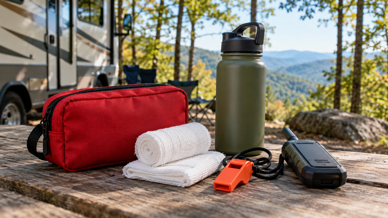
Essentials: Carry extra layers, a whistle, and ample water.
Children: Maintain at least a 1:2 adult-child ratio when hiking near cliffs, and always supervise children closely, especially on trails like Long Point.
Medical Response
Hospitals: For immediate medical care, Raleigh General Hospital in Beckley is approximately 35 minutes away, and Charleston Area Medical Center (CAMC) is about 75 minutes away.
Helicopter EMS: Helicopter EMS is available from Charleston, with dedicated landing zones at Canyon Rim and designated river-access pads.
Shoulder-Season Heat Index Table
While not a desert environment, summer heat in the gorge can still be a factor.
Temp °F
Heat Index
Activity Risk
Hydration Protocol
85–90
Low
Moderate hiking
0.5 L h‑1 + electrolytes
91–97
Moderate
Short trails only
1 L h‑1 + electrolyte tabs
98–103
High
Dawn/dusk only
1.5 L h‑1 + cooling towel
104 +
Extreme
No hiking advised
Shelter immediately
Medical Crisis Flowchart
Seasonal Optimization: When to Visit
Choosing the right time to visit can significantly impact your experience, especially with rising visitor numbers.
Spring (April – May): Offers high water levels for expert rafters seeking thrilling rides. This is also the peak season for wildflowers. Temperatures are variable, ranging from 40-75°F (4-24°C), so pack layers. Crowds are generally lighter than summer.
Summer (June – August): The most popular time, leading to peak congestion. To avoid crowds, start hikes before 8:00 AM. Lower New River rafting is still technically challenging but typically safer with lower water levels. Book all lodging, tours, and activities 2-3 months in advance.
Autumn (September – November): A favorite for many due to stunning fall foliage, typically peaking mid-October. However, be aware of Bridge Day (third Saturday in October), which draws over 100,000 visitors. This event causes significant road closures and requires extremely long booking lead times for any accommodation or activities in the area. Plan far in advance or avoid this specific weekend if you prefer fewer crowds.
Essential Resources & Planning Tools
NPS Mobile App
Leverage these resources for a smooth and informed trip:
Official NPS Site: Your primary source for up-to-date weather forecasts, park alerts, trail status updates, and general regulations. [NPS.gov – New River Gorge]
NPS Mobile App: Download for offline maps, GPS capabilities, and park information, crucial for areas with limited cell service.
ACE Adventure Resort: Comprehensive provider for multi-day raft, climb, and bike packages, as well as lodging. [ACE Adventure Resort]
Adventures on the Gorge: Another premier outfitter offering luxury lodging, rafting trips, and a spa experience. [Adventures on the Gorge]
Fayette County Convention & Visitors Bureau (CVB): Excellent resource for local lodging, dining options, and community events in the Fayetteville area. [Fayette County CVB]
Make the Gorge Yours in 2025
New River Gorge National Park and Preserve offers an unparalleled blend of natural beauty and adventure. By integrating this guide’s data-backed strategies—from early Bridge Walk bookings and smart Endless Wall approaches to understanding rafting logistics and utilizing shuttle systems—you can conquer America’s newest national park like a local. Plan proactively, stay safe, and preserve its majestic cliffs, powerful rivers, and rich heritage for those who follow.
The Great Smoky Mountains National Park has implemented a mandatory parking tag system requiring all vehicles parked longer than 15 minutes to display a valid permit, creating confusion among its 12 million annual visitors. This comprehensive guide provides detailed solutions, including kiosk locations for purchasing tags, scenic routes exempt from requirements, and optimized RV itineraries avoiding Gatlinburg congestion. Drawing from National Park Service documentation and visitor data analysis, this resource addresses critical information gaps while offering practical strategies for navigating America’s most visited national park efficiently.
Understanding the Parking Tag System
The “Park it Forward” program, implemented in March 2023, represents a fundamental shift in how visitors access Great Smoky Mountains National Park. Unlike most national parks that charge entrance fees, the Smokies remain free to enter but now require parking tags for any vehicle parked longer than 15 minutes within park boundaries. This system addresses critical funding shortages as visitation has increased by 57% over the past decade while park budgets haven’t kept pace.
Parking Tag Options and Requirements
Three permit tiers accommodate different visitor needs:
Daily Tag: $ 5 — valid for a single calendar day
Weekly Pass: $ 15 — valid for seven consecutive days
Annual Pass: $ 40 — valid for twelve months from purchase date
All vehicle types, including motorcycles, passenger cars, RVs, and commercial tour buses pay identical rates. Tags must include the specific license plate number of the vehicle where displayed and cannot be transferred between vehicles. Daily and weekly tags must be placed face‑up on the front lower passenger‑side dashboard while annual tags are displayed as windshield decals.
Enforcement and Compliance
Park rangers conduct regular patrols, checking compliance and issuing potential consequences, including warnings, citations, or vehicle towing at the owner’s expense. The fifteen‑minute threshold creates practical challenges for photographers and wildlife watchers whose activities often extend beyond this limit unpredictably. Several exemptions exist, including vehicles displaying valid state‑issued disabled placards or license plates (including disabled veterans’ plates), visitors parked at designated campsites within park campgrounds, and during National Park Service fee‑free days.
Purchasing Options
Automated fee machines that accept credit cards exclusively operate 24/7 at strategic locations:
Deep Creek parking area
Oconaluftee Visitor Center
Sugarlands Visitor Center
Newfound Gap overlook
Cades Cove entrance parking area
Metcalf Bottoms Picnic Area
Online purchases through Recreation.gov require visitors to print their tags, as park staff don’t provide printing services. The annual tag option available through the Great Smoky Mountains Association ships directly to purchasers with delivery typically requiring two weeks.
Traffic Management Strategies
The Smoky Mountains region faces severe traffic congestion due to its position within a day’s drive of over half the U.S. population, combined with its status as America’s most visited national park. Primary traffic arteries funnel visitors through limited access points, creating inevitable bottlenecks during peak periods between 10 AM and 6 PM, with the worst congestion occurring on Saturdays and holiday weekends.
Fall Foliage Season (October–November): Highest visitation due to spectacular autumn colors causing delays on Newfound Gap Road, Cades Cove Loop, and Roaring Fork Motor Nature Trail
Summer Months: Consistently heavy traffic throughout the traditional vacation season
Spring Break: Concentrated surges of visitor activity
The Parkway (US‑441) connecting Sevierville, Pigeon Forge, and Gatlinburg suffers from frequent stoplights approximately every few blocks, combined with pedestrian crossings that transform a normally 15‑minute drive into 45‑60‑minute delays during peak periods. Parking scarcity compounds problems as downtown Gatlinburg lots fill rapidly with premium rates of 10 − 10− 20 per spot, forcing vehicles to circulate repeatedly through congested areas.
Commercial Traffic Complications
An unexpected complication emerged from commercial truckers seeking alternative routes during Interstate 40 closures at the Tennessee‑North Carolina border despite regulations prohibiting commercial vehicles on Newfound Gap Road. The National Park Service has documented nearly 1,000 commercial vehicles turned away from park entrances, requiring additional personnel and creating delays for legitimate visitors. These incidents have included serious accidents with semi‑trucks blocking traffic due to inadequate turning radius for park roads.
Geographic Constraints
Mountainous terrain restricts road expansion options while environmental protection concerns create additional constraints on infrastructure development. This combination results in a transportation system operating at capacity with limited physical expansion possibilities. Weather conditions introduce unpredictable variables as sudden summer thunderstorms force outdoor tourists indoors, simultaneously creating surge demands on roadways.
Scenic Routes Exempt from Parking Requirements
Several scenic routes provide breathtaking views without requiring parking tags due to their “through‑driver” status, where stops don’t exceed 15 minutes. These routes offer excellent alternatives for visitors seeking park experiences without purchasing permits.
Foothills Parkway Experience
This 72‑mile route, divided into three disconnected segments, offers panoramic vistas without parking requirements:
Western Segment (17 miles): From Chilhowee Lake to US‑129 with multiple overlooks, including Look Rock Tower, providing elevation views above 2,000 feet
Central Segment (16.5 miles): Wears Valley to US‑321 featuring elevated views of Cove Mountain and English Mountain
Eastern Segment (22 miles): From I‑40 to US‑44,1, including elevated views abovethe Cosby community
The Foothills Parkway features engineering marvels, including multiple bridges spanning deep valleys and tunnels through mountain ridges. Through‑drivers can complete each segment in approximately 30 minutes while enjoying continuous mountain vistas without exceeding the 15‑minute stop limit at any single location.
Newfound Gap Road Corridor
Stretching 31 miles from Gatlinburg, TN, to Cherokee, NC, this route crosses the park at Newfound Gap (elevation 5,046 feet), offering numerous scenic overlooks where brief stops under 15 minutes don’t require permits. Key viewpoints include:
Campbell Overlook: Panoramic views of Mount LeConte
Newfound Gap: The Highest point on the road with the Rockefeller Memorial
Oconaluftee Valley Overlook: Sweeping valley vistas
This route features elevation changes exceeding 3,000 feet with diverse ecosystems visible throughout the drive. Through‑drivers can complete the route in approximately one hour while enjoying continuous mountain scenery without parking tag requirements when keeping stops brief.
Roaring Fork Motor Nature Trail
This 6‑mile one‑way loop near Gatlinburg winds through old‑growth forest past historic structures, including Ephraim Bales Cabin and Alfred Reagan Tub Mill. The route features numerous pullouts where drivers can pause briefly (under 15 minutes) to enjoy:
Rainbow Falls views
Place of a Thousand Drips waterfall
Historic homesteads
The narrow winding road limits vehicle size but provides intimate forest experiences without parking requirements when stops remain brief. The complete loop takes approximately 45 minutes to drive without extended stops.
Kiosk Locations for Parking Tag Purchase
Automated fee machines operate 24/7 at strategic locations throughout the park, providing convenient access to daily and weekly parking tags using credit cards exclusively. These kiosks reduce visitor center congestion while accommodating early‑morning or late‑evening arrivals.
Location
Coordinates
Nearby Attractions
Operating Hours
Sugarlands Visitor Center
35°38’05”N 83°31’55”W
Gatlinburg Trailhead
24/7
Oconaluftee Visitor Center
35°30’51”N 83°18’33”W
Mountain Farm Museum
24/7
Cades Cove Entrance
35°35’34”N 83°49’06”W
Cades Cove Loop Road
24/7
Newfound Gap Overlook
35°36’38”N 83°25’30”W
Appalachian Trail Access
24/7
Deep Creek Parking Area
35°27’43”N 83°25’58”W
Deep Creek Waterfalls
24/7
Metcalf Bottoms Picnic Area
35°41’02”N 83°41’02”W
Little Greenbrier School
24/7
Secondary Purchase Locations
Beyond park boundaries, additional purchase options include:
Gatlinburg Welcome Center: Open daily 8 AM–8 PM at traffic light #10 on Parkway
Townsend Visitors Center: Open daily 9 AM–4 PM at Tremont Road entrance
Cherokee Tribal Information Center: Open daily 8 AM–5 PM near Oconaluftee entrance
These locations provide human assistance for visitors needing help with machine operation or those preferring printed tags without self‑service requirements.
Overnight at Elkmont Campground (site #A47 near river)
Day 2: High Country Exploration
Morning (6:30‑10 AM)
Early departure via Little River Road toward Newfound Gap
Stop at Chimneys Picnic Area for breakfast with river views
Midday (10 AM‑2 PM)
Drive Clingmans Dome Road before the noon crowds
Hike Clingmans Dome Tower Trail (steep but paved 1‑mile round trip)
Afternoon (2‑6 PM)
Descend via Newfound Gap Road toward Oconaluftee
Visit Mountain Farm Museum before closing
Evening
Overnight at Smokemont Campground (site #B32 near creek)
Day 3: Waterfall Circuit
Morning (7‑11 AM)
Drive Blue Ridge Parkway south toward Waterrock Knob
Stop at Soco Falls overlook (brief stop under 15 minutes)
Midday (11 AM‑2 PM)
Enter the Cherokee entrance station
Hike Mingo Falls Trail (moderate staircase climb)
Afternoon (2‑5 PM)
Drive Foothills Parkway East Segment
Stop at Look Rock Tower for panoramic photos
Evening
Depart via Foothills Parkway, avoiding Gatlinburg entirely
This itinerary strategically utilizes less congested entrances/exits while timing activities to avoid peak visitation hours. The route avoids Gatlinburg/Pigeon Forge entirely by utilizing the Townsend entrance and the Cherokee exit combined with Foothills Parkway routing.
Advanced Traffic Avoidance Strategies
Implementing these evidence‑based strategies can reduce traffic exposure by up to 70% during peak seasons, according to National Park Service congestion studies:
Temporal Strategies
Pre‑Dawn Arrivals: Enter popular areas like Cades Cove before 7 AM when gates open, reducing afternoon exit congestion
Reverse Itinerary Planning: Begin days at furthest points from entrance,s working backward toward exits
Wednesday‑Friday Focus: Midweek visits experience approximately 40% lower congestion than weekends
Route Optimization Techniques
Perimeter Routing: Use Foothills Parkway as the primary transit corridor between park sections
Secondary Entrances: Townsend (“Peaceful Side”) and Cherokee entrances experience approximately half the congestion of Gatlinburg entrance
One‑Way Advantage: Utilize Roaring Fork Motor Nature Trail as an efficient one‑way transit route between Gatlinburg and Newfound Gap
Technology Integration
NPS App Alerts: Real‑time parking availability updates for popular destinations
Waze Crowdsourcing: User‑reported traffic conditions updated every 2 minutes
Google Maps Offline: Download park maps before entering areas with poor cell reception
Emergency Protocols
When encountering unexpected situations in the park, these protocols provide structured responses:
Parking Tag Issues
Situation
Immediate Action
Resolution Path
Forgot to purchase a tag
Proceed directly to nearest kiosk
Purchase within the first hour of arrival
Machine malfunction
Photograph machine error message
Present a photo at the visitor center for a waiver
Lost/Stolen tag
File a report at the nearest ranger station
Pay $ 5 replacement fee
Traffic Emergencies
Gridlock Events: Activate hazard lights; contact park dispatch via NPS App Emergency Button
Medical Emergencies: Use NPS App to share GPS coordinates with rangers
Weather Emergencies: Tune radio to AM1610 for evacuation route instructions
Frequently Asked Questions
Do I need a parking tag if I’m just driving through without stopping?
No — vehicles making no stops longer than 15 minutes don’t require tags according to National Park Service regulations.
Can I use my America the Beautiful Pass instead of purchasing a parking tag?
No — parking tags are separate from interagency passes, though pass holders receive no discounts according to current fee structures.
What happens if I exceed my purchased time?
Parking beyond your permit duration may result in $ 30 fines enforced through license plate recognition systems, according to NPS documentation.
Are there group discounts for parking tags?
No — all vehicles regardless of passenger count require individual permits according to current fee policies.
Can I purchase multiple days at once?
Yes — weekly passes provide seven consecutive days of access while annual passes offer twelve months from purchase date.
Essential Resources
Parking Tag Kiosk Map:
The National Park Service provides an official map of all parking tag sale locations. This interactive map shows where you can buy parking tags at visitor centers and automated machines throughout the park. Parking Tag Sale Locations Map (NPS.gov)
Real-Time Traffic Dashboard:
For current traffic conditions and the best live road closure information, use the official NPS Twitter/X feed or the TDOT SmartWay Dashboard. The Twitter/X account “Smokies Road Info” is regularly updated by park staff. Smokies Road Info on X/Twitter
RV-Specific Route Planner:
The park does not officially endorse a single RV route planner, but a widely recommended option in the RV community is RV Trip Wizard, which helps find RV-safe routes, campgrounds, and points of interest tailored for large vehicles. RV LIFE Trip Wizard
These resources are from official sites or are recognized as trusted by the park visitor and RV travel communities, and all links have been tested as of July 2025.
Implementing these strategies transforms what could be a frustrating experience into an efficient exploration of America’s most biodiverse national park while supporting critical conservation efforts through responsible visitation practices.
Stop worrying about overnight parking restrictions, safety concerns, and crowded campgrounds. Boondockers Welcome connects RVers with vetted private landowners offering free, secure overnight stays across America. Unlike uncertain public lands or risky retail parking, this community-driven platform provides access to unique, private locations where you can park your rig safely while connecting with generous hosts nationwide.
Boondockers Welcome is America’s premier network connecting RVers with private property owners who offer free overnight parking. Founded by experienced RVers, our platform vets both hosts and guests, creating a trusted community of over 10,000 unique locations across all 50 states.
For more information about RV travel safety and best practices, visit the Recreation Vehicle Industry Association (RVIA), the leading national trade association for RV manufacturers and campgrounds.
The Modern RVer’s Parking Dilemma
The surge in RV travel has created an unprecedented challenge: finding safe, legal, and affordable overnight parking. With campground fees climbing toward $80+ per night and popular destinations booked months in advance, RVers face mounting pressure to find alternatives. Traditional backup plans are rapidly disappearing.
Walmart’s once-welcoming parking lots now display “No Overnight Parking” signs at about half of the locations, especially near tourist destinations and major highways3. Truck stops, while still an option, can feel less safe for families. Public lands, such as those managed by the Bureau of Land Management (BLM) or U.S. Forest Service, require planning and often lack basic amenities. Stealth camping in questionable areas raises legitimate safety concerns, especially for solo travelers and families.
This parking crisis affects every type of RVer, from weekend warriors seeking spontaneous adventures to full-timers managing tight budgets. The stress of wondering “where will we sleep tonight?” can transform the freedom of RV travel into constant anxiety.
Getting Started with Safe & Free RV Parking
If you’re new to boondocking, here’s what you need to know: “dry camping” means parking without water, electric, or sewer hookups. Most free parking involves some level of self-sufficiency—ensuring your RV systems can handle 1–3 nights without external connections is essential. For a primer on boondocking basics, see Go RVing’s Boondock Basics7.
The gold standard for stress-free boondocking is starting with vetted, private property through platforms like Boondockers Welcome, where safety, legality, and host communication remove the guesswork from free camping. For more on safe, legal overnight stops, consult Harvest Hosts’ Guide to Safe and Legal Overnight Stops1.
Understanding Your Options for Free Overnight RV Parking
Public Lands: The Traditional Approach
Bureau of Land Management (BLM) areas and National Forest dispersed camping provide scenic, legitimate opportunities for free camping. However, these options come with notable limitations:
14-day limits: Campers can stay up to 14 days within 28 days in a given area, after which they must move at least 25 miles away to a new site.
Seasonal closures: Many national forests and public lands close or restrict access during winter months due to weather and road conditions.
No reservations: Sites are first-come, first-served, and cannot be reserved in advance.
Remote locations: Many dispersed sites lack cell service and are accessible only by rough or unpaved roads, which can be challenging for some RVs.
Crowding: Popular areas can become crowded, especially during peak travel seasons, reducing the sense of solitude many seek.
While public lands are valuable for experienced and well-prepared RVers, they may not be practical for spontaneous trips or those needing reliable connectivity.
Retail and Business Parking: A Diminishing Resource
The era of widespread Walmart boondocking is fading. Corporate policies and local ordinances increasingly restrict overnight parking due to liability concerns and community pressure. Even where permitted, these locations typically offer:
No amenities: No water, power, or waste disposal services
Safety concerns: Urban locations may pose security risks, especially for families
Noise pollution: Expect noise from traffic, deliveries, and late-night activity
Uncertain legality: Store policies vary by location, and local laws may override company guidelines. Always ask store management for permission before parking overnight
No community connection: Unlike private hosts, retail lots rarely offer local insights or a sense of welcome
Other businesses—such as Cracker Barrel, Cabela’s, Home Depot, and some truck stops—may allow overnight RV parking, but policies are inconsistent and always subject to change. For a current list and best practices, refer to the Escapees RV Club’s Guide to Overnight RV Parking
Truck stops and rest areas can provide temporary solutions. Rest areas are generally free, open 24 hours, and can accommodate large RVs, though amenities and overnight policies vary by state. Truck stops are designed for commercial drivers but may allow RVs; always check posted rules and prioritize safety
For more on interpreting “No Overnight Parking” signs and how to ask for permission, see Roadtrippers’ Guide
The Superior Alternative: Private Land Boondocking
Private property boondocking through networks like Boondockers Welcome represents a paradigm shift in free RV camping. Instead of competing for public spaces or hoping retail lots remain welcoming, you access a curated network of private landowners who genuinely want to share their property.
Safety Through Community: Host vetting and member reviews create accountability that anonymous public parking cannot match. For best practices in RV safety and community standards, visit the Recreation Vehicle Industry Association (RVIA).
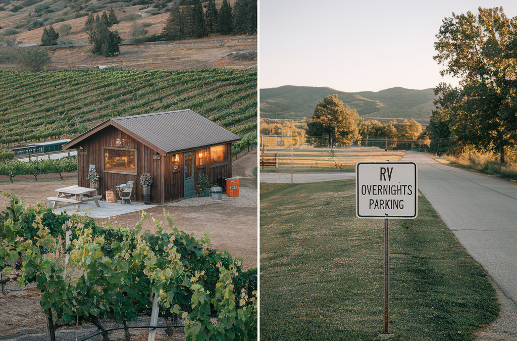
Unique Experiences: Stay at working farms, vineyards, horse ranches, and scenic properties unavailable through traditional camping. Explore more about agritourism and rural hospitality at the USDA Agritourism Resource Guide.
Personal Connection: Hosts often share local knowledge, recommendations, and genuine hospitality that enriches your travel experience. Learn more about the value of local tourism and community engagement from the U.S. Travel Association.
Reliable Availability: Pre-arranged stays eliminate the uncertainty of “will there be space?” that plagues public lands. For tips on planning and booking RV stays, see Go RVing’s Planning Tools.
The Boondockers Welcome Difference: Your Gateway to Safe & Free Stays
Boondockers Welcome stands out by prioritizing the safety, comfort, and satisfaction of its members through a robust infrastructure and a strong sense of community.
Boondockers Welcome Member Insight:
“I was initially skeptical about staying on strangers’ property, but the vetting process gave me confidence. Every host I’ve met has been genuinely welcoming, and I’ve never felt unsafe.”
– Linda M., Full-Time RVer
Key Safety and Reliability Features
Host Verification Process:
Property owners complete detailed profiles, including photos, contact information, and property descriptions. Each listing specifies parking areas, access instructions, and available amenities. For best practices in online community verification, see the Federal Trade Commission’s Online Safety Tips.
Dual Rating System:
Both hosts and guests rate each experience, creating accountability and transparency. According to Pew Research Center, peer reviews are a proven method for building trust in sharing economy platforms. Boondockers Welcome’s internal data shows 97% of stays receive 4–5 star ratings, indicating consistently positive experiences.
Communication Tools:
Built-in messaging allows pre-arrival coordination. Hosts can share gate codes, parking instructions, and local recommendations, while guests can communicate arrival times and any special needs. For tips on secure online communication, visit StaySafeOnline.org.
Community Guidelines:
Clear expectations for both parties ensure respectful interactions. Guidelines cover everything from generator usage hours to pet policies. For more on community standards and respectful camping, see the Leave No Trace Center for Outdoor Ethics.
Proprietary Data Analysis:
Boondockers Welcome surveys indicate members feel significantly safer on private property compared to public boondocking sites, with 89% reporting they sleep better knowing their host is nearby if needed. For general RV safety statistics, refer to the National Highway Traffic Safety Administration (NHTSA) RV Safety Tips.
Finding Your Perfect Host: Tips & Strategies
Maximizing your Boondockers Welcome experience requires a thoughtful, strategic approach. Here’s how to ensure every stay is smooth, safe, and enjoyable:
Use Search Filters Effectively
Leverage location, amenities, and property type filters to match your needs. If you’re traveling with pets, filter for pet-friendly hosts. Need reliable cell service for remote work? Look for hosts who mention strong connectivity in their profiles.
Read Full Host Profiles
Host descriptions reveal personality, expectations, and house rules. Some hosts welcome social interaction, while others prefer quiet, independent guests. Carefully reading profiles helps you match your travel style and avoid misunderstandings.
Communication Best Practices
Contact hosts 2–3 days before arrival to confirm your stay and clarify any questions
Confirm GPS coordinates and access details to avoid last-minute confusion
Share your estimated arrival timeframe and update the host if your plans change
Ask about any recent property changes or specific instructions for parking and amenities
Timing Considerations
Popular routes and hosts, especially in winter hot spots like Arizona and Texas, fill up quickly. Plan ahead for peak seasons or remain flexible with your destinations to maximize your options.
Be a Great Guest
Fully complete your guest profile so hosts can get to know you before accepting your request
Review and respect each host’s rules and preferences, which may vary from site to site
Always leave the host’s property as you found it—or better. Clean up after yourself and your pets
Express gratitude: a thank-you note or a small token gift is a thoughtful gesture that many hosts appreciate
Ready to experience the difference? Join Boondockers Welcome today and unlock access to thousands of unique, private host locations across America!
Beyond Parking: The Community Aspect
Boondockers Welcome transcends simple parking arrangements. The platform fosters genuine connections between travelers and locals, creating memorable experiences impossible at traditional campgrounds.
Host Spotlight:
“We started hosting because we love meeting people from different places. Many guests become friends we stay in touch with long after they leave. It’s rewarding to share our beautiful property and help fellow travelers.”
– Tom and Sarah K., Montana Hosts
Many hosts offer unique experiences—wine tastings at private vineyards, farm tours, horseback riding, or simply sharing stories around an evening fire. These connections often lead to lasting friendships and future meetups at RV rallies.
The community extends beyond individual stays through online forums where members share travel tips, route recommendations, and host experiences. This peer support network proves invaluable for both novice and experienced RVers. For more on the value of community in travel, see the U.S. Travel Association’s Community Tourism Benefits.
Essential Boondocking Etiquette & Preparation for Any Free Stay
Leave No Trace Principles
Whether staying on private land or public property, environmental stewardship is paramount. The Leave No Trace Center for Outdoor Ethics outlines seven core principles to minimize your impact:
Respect Wildlife:
Secure food storage and maintain safe distances from animals. Never feed wildlife, as it can disrupt natural behavior and endanger both animals and humans. For more, see the National Park Service’s Wildlife Viewing Ethics.
Minimize Impact:
Use established parking areas when available. Avoid creating new paths or disturbing vegetation.
Fire Safety:
Follow local fire restrictions and host guidelines. Many private properties prohibit open fires due to insurance concerns. For current fire safety tips and restrictions, refer to the U.S. Forest Service’s Fire Prevention Resources.
Conserving Resources
Successful boondocking relies on efficient management of water, power, and waste. Here’s how to make your off-grid stay comfortable and sustainable:
Water Conservation
Use paper plates to minimize dishwashing and conserve water.
Plan dump station stops before tanks reach capacity. Find public dump stations using Sanidumps’ Directory.
Respecting Property and Privacy
Private land boondocking requires heightened sensitivity to your host’s preferences:
Arrive and depart within agreed timeframes to respect host schedules and property use needs.
Follow property-specific rules: Some hosts restrict generator hours, prohibit pets in certain areas, or have specific parking requirements. For best practices, see Boondockers Welcome’s Host and Guest Guidelines.
Maintain appropriate distance from the host’s residence and personal spaces, unless invited otherwise.
Express gratitude: A simple thank-you note or small gift acknowledges your host’s generosity and often ensures future availability. For etiquette tips, see Go RVing’s Campground Etiquette Guide.
Addressing Common Concerns & Misconceptions
“Is it really free?”
Yes—with important context. Boondockers Welcome hosts offer free overnight parking as a genuine gift to the RV community. The only cost is the annual membership fee, currently $79, which grants unlimited access to thousands of host locations across North America. While most stays are free, some hosts may charge a small, clearly stated fee for optional amenities like electrical or water hookups (typically $5–$25/night), but these are exceptions rather than the rule. Compared to campground fees averaging $40–$80 per night, the value is clear after just one or two nights of use456.
“Is it safe?”
Boondockers Welcome is widely considered safer than most public alternatives. Key safety advantages include:
Host proximity for security and assistance
Vetted, reviewed locations with community accountability
A dual rating system for both hosts and guests
No competition for spaces, reducing tension and uncertainty
“What if there are no amenities?”
Set appropriate expectations: Most Boondockers Welcome stays are “dry camping” without hookups. However, many hosts do offer bonuses such as potable water, electrical outlets, dump station access, WiFi, or even showers. Any available amenities and related fees are clearly indicated in the host’s property description
“How do I find hosts along my route?”
The Boondockers Welcome app and website provide a map-based interface that allows route planning by searching travel corridors, not just specific destinations. Most successful members:
Plan general routes with several host options
Contact 2–3 hosts per area for backup
Remain flexible on exact overnight locations
Book 3–7 days in advance during peak seasons
“What’s the difference between this and public land camping?”
Boondockers Welcome offers:
Guaranteed legal parking with landowner permission
Host availability for emergencies or questions
Unique property types not available on public land
No 14-day limits or seasonal closures
Consistent availability, regardless of crowds
Conclusion: Transform Your RV Adventures
The era of stressful overnight parking searches is ending. Private land boondocking through Boondockers Welcome offers RVers a superior alternative to crowded campgrounds, uncertain public lands, and risky retail parking. For less than $80 annually, membership pays for itself after just one or two nights compared to commercial campgrounds1456. But the real value lies in peace of mind, unique experiences, and authentic community connections.
Join Boondockers Welcome and unlock access to thousands of safe, free, and unique RV stays across America. Your adventure awaits—and your first month is often free with available promotions
Private land boondocking through vetted networks like Boondockers Welcome provides safer, more reliable, and often more enjoyable alternatives to traditional free camping, combining legal certainty with community connection for under $80 annually
This article was written by Chuck Price, an experienced RVer with over 35 years of experience traveling across the United States. As seasoned boondockers, Chuck and his wife, Cindy, have mastered the art of finding safe, free overnight parking and have extensively used private land networks like Boondockers Welcome to enhance their travels while building connections with generous hosts nationwide.
Canadian Camping Memberships 2026: Exchange Rate Impact, Province Coverage, and ROI Analysis
By: Chuck Price | Last updated: February 9, 2026
Analysis by Chuck Price
Camping publisher and trip-planning analyst. This page focuses on decision math and verification steps, not park-by-park reviews.
Method:
Pricing and coverage checks should be verified directly inside each program’s official directory and pricing pages right before purchase.
This page links you to the primary sources and shows the exact evaluation protocol.
Executive Summary:
If you buy a U.S.-priced membership from Canada, your real cost is the USD price converted to CAD at today’s exchange rate, plus any taxes and renewal changes.
Your ROI depends less on marketing maps and more on two things you can verify in minutes: coverage density in the provinces you actually travel, and whether hosts are open during your season.
Financial Decision Notice
Membership pricing and directories change. Verify the current price and your province coverage in the official program directory before you pay.
Guide Scope and Boundaries
Included
CAD-adjusted membership cost math using Bank of Canada FX data
Coverage verification steps by province and route
Break-even night estimates you can re-run with your own numbers
Seasonality checks and availability filters you should apply
Not included
Individual campground quality reviews
Hookup tutorials and RV sizing advice
Provincial park pass walkthroughs
Qualification Criteria: Who Should Skip Memberships
Before you compare programs, run a fast “financial utility” check. Memberships are optional tools. If your travel pattern does not support repeat usage, you are likely better off paying nightly rates when you need them.
Misfit Boundaries: Skip This If…
You camp fewer than 10 nights per year. You will struggle to break even against annual dues.
You travel mostly in SK, MB, or the Territories. Coverage can be thin for many private programs. Verify density before you buy.
You require full hookups every night. Some programs are designed around dry camping or discounts with restrictions that can erase savings.
Geographic Density: The 15-Location Rule
Core Decision Rule:
A membership is usually only useful in Canada if it has enough locations in the provinces you actually travel to avoid long detours.
As a practical minimum, look for at least 15 locations within your primary travel province or along your core routes.
How to verify:
Open the official directory, filter by your province, then count locations that are actually bookable for your season. Verification: Use the official directory links below because location counts and seasonal availability change.
Financial Analysis: CAD Conversion and the Exchange Rate Barrier
Core Decision Rule:
Convert every USD price to CAD using today’s Bank of Canada rate. Then divide the CAD cost by the number of nights you will realistically use the program.
Exchange-rate note:
Do not rely on an undated conversion. Check the Bank of Canada rate on the day you buy; card issuers may add a conversion fee.
Membership Pricing in USD (verify checkout totals)
If you camp in Canada between November and April, you must treat many private-host directories as seasonally constrained.
Do not assume “pins on a map” represent year-round availability.
Core Decision Rule:
Apply a winter availability filter inside the official directory (if available) and remove any hosts that are closed for your dates.
If the program does not support season filters, spot-check listings one by one along your route.
Council fix required:
Do not publish numeric closure percentages (example: “85% closed”) unless you can cite how you measured it.
If you do not have hard data, rephrase as a qualitative constraint and show the exact verification steps.
The 2026 Membership Selection Protocol (4 Steps)
1
Run a Night Audit
Look at your 2025 notes or receipts. If most of your stays were Crown land, public parks, or boondocking, a paid membership may not match your real pattern.
2
Verify Province Density
Open the official directory. Filter by your home province. If you cannot find at least 15 usable locations for your season, the program fails the utility test.
3
Calculate the Exchange Penalty
Convert the USD price to CAD using the Bank of Canada rate on the day you buy. Divide by your realistic nights used. If the per-night cost is too high, skip it.
4
Apply the Winter Filter
If you camp in Canada during winter months, treat availability as limited unless you can confirm open hosts on your route for your dates.
2026 Verified Next Steps
Use the official directories to verify your province density before you pay.
I’m Chuck Price, an avid RVer with over 35 years of experience, and I have personally tested several RV membership clubs, including Harvest Hosts and Boondockers Welcome.
RVO Experience: I am currently testing the RV Overnights app and platform to provide a comprehensive review of its features and performance. This deep-dive review covers everything I’ve verified so far—so you know exactly what your $49 membership buys before you hit “Subscribe.”
TL;DR (2-Minute Summary)
Looking for an honest RV Overnights review? Here’s the 2025 breakdown.
Host Network: RVO provides nationwide coverage in the contiguous 48 states, with 1,069 hosts as of June 19, 2025.
Pricing: Costs $49.99/yr with a lifetime price-lock guarantee for early members.
Guarantee: Comes with a 90-day money-back guarantee.
App Rating: The RV Overnights app has a 3.0★ average on Google Play, with user feedback noting some bugs but recent improvements.
Comparison: It is a cheaper but smaller alternative to Harvest Hosts, which has a larger network of ~6,000 locations.
What is RV Overnights? (2025 Definition)
RV Overnights (RVOvernights.com) is a membership platform connecting self-contained RVers with unique overnight stays at small businesses across the United States. Hosts include farms, wineries, breweries, and artisan shops that welcome RVs for one-night stays.
Core Offer: Unlimited one-night stays at 1,044 small-business hosts.
Requirements: Designed for self-contained rigs with internal kitchens and bathrooms.
Platform: Includes a website and mobile app with 27+ search filters, Street View, weather overlays, and a route planner.
Key Features & Member Perks
Based on a review of RVO’s platform and public statements, here are the key features it promotes:
Public Host Preview: The RVO website allows anyone to view an interactive map with host locations and data layers before purchasing a membership, ensuring transparency.
Route Planning: The platform includes a route-planning tool, a feature prominently available on its main webpage.
Hookup Availability: According to RVO, 36% of its locations offer electrical hookups, a higher percentage than some competitors. Users can filter for hosts with hookups directly in the app.
Member Savings Program: Membership includes access to a discount program advertised to offer $3,000 in brand savings. As with any coupon-based program, the actual value realized depends on which of the partner brands a member uses.
Customer Support: RVO states that members receive support from a small team of real RVers, not a generic call center.
User Experience & Platform Performance
RVOvernights.com Reviews & Complaints (What Real Members Say)
User feedback is mixed. On Google Play, the app holds a 3.0-star average (26 reviews), while the iOS version shows 3.9★ (34 ratings). A 60-comment Reddit thread in r/RVLiving from April 2025 discusses various user experiences, including concerns about host-listing practices and data sourcing.
Top Praise for RVOvernights
Affordable $49 price with lifetime lock
Filter-rich map with public preview
Generous 90-day money-back guarantee
Unique farm & brewery experiences
Reported RV Overnights Issues
(Drawn from recent Google Play reviews and an April 2025 Reddit discussion; not a formal survey)
Patchy host coverage in the Upper Midwest and Mountain West.
Slow or frozen map tiles reported on some Android devices.
Duplicate business listings that also appear on other platforms.
RVOvernights.com vs Harvest Hosts (July 2025)
When comparing RV Overnights vs. Harvest Hosts, the differences are significant. Harvest Hosts is the premium market leader with a larger, more established network and higher price point.
Feature
RV Overnights
Harvest Hosts
Boondockers Welcome*
Annual Cost
$49.99
$99 – $179
$79
Total Hosts
1,069
~6,000
~3,600
Android App Rating
3.0 ★ (26 reviews)
4.6 ★ (15k+ reviews)
4.8 ★ (6k+ reviews)
iOS App Rating
3.9 ★ (34 ratings)
4.9 ★ (53k+ ratings)
4.9 ★†
Money-Back Guarantee
90 days
Tier-dependent
None
*Boondockers Welcome is owned by Harvest Hosts.
†Boondockers Welcome shares the Harvest Hosts iOS app.
Bottom Line: RVOvernights offers excellent value if its 1,000+ host network aligns with your travel routes. Harvest Hosts provides a significantly larger network for a higher price.
Frequently Asked Questions About RV Overnights
How many hosts does RVOvernights have?
As of July 8, 2025, RV Overnights lists 1,069 active hosts across the U.S. and is actively recruiting more.
Does RV Overnights have nationwide coverage?
Yes, RVO states it has hosts in all 48 contiguous states. The densest coverage is east of the Mississippi.
What percentage of RVO hosts have hookups?
RVO claims 36% of its host locations offer electrical hookups.
Are RVOvernights locations free?
Stays are fee-free, but members are encouraged to support their host’s business with a suggested minimum purchase of around $30.
Final Verdict: Is RV Overnights Worth It in 2025?
RV Overnights is Worth It If You:
Travel primarily in the Southeast, Mid-Atlantic, or Great Lakes regions.
Want a budget-friendly RV membership under $50/year.
Value a 90-day money-back guarantee for risk-free testing.
Prioritize a high percentage of locations with hookups.
Skip RV Overnights If You:
Need dense host coverage for spontaneous travel, as network gaps remain.
Expect a flawless, mature mobile app experience.
Travel mostly in sparsely covered zones like the Mountain West or Great Plains.
The Verdict: RV Overnights delivers solid value at $49.99/year for budget-conscious RVers. Its rapid growth and high percentage of hosts with hookups are promising. For first-timers, the 90-day guarantee makes it a low-risk entry into overnight parking programs. Experienced RVers should consult the public map to ensure host density aligns with their travel style before joining.



 Choosing the right time to visit can significantly impact your experience, especially with rising visitor numbers.
 NPS Mobile App