Last updated: October 22, 2026
Chuck Price has 35+ years of RV camping experience and owns a 2018 Hymer Aktiv Class B.
Dispersed camping is camping on public land away from developed campgrounds, as the BLM defines it. With no developed facilities, plan to bring your own water and pack out your trash.
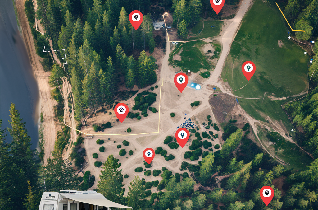
Google Maps satellite and terrain views help you spot dirt roads and cleared sites, but the map does not show whether camping there is legal. Bureau of Land Management (BLM) guidance allows dispersed camping on most BLM land unless an area is posted closed or has other restrictions, generally for 14 days in any 28-day period.
- Must-know: Google Maps is for scouting. On national forests, a road missing from the Motor Vehicle Use Map (MVUM) is closed to vehicles, per the USDA Forest Service.
- Trip killers: National Park Service (NPS) regulation bars camping outside designated sites or areas, per 36 CFR 2.10.
- Best for: Finding existing clearings and turnouts with the Satellite layer, then reading elevation on the Terrain layer, per Google Maps Help.
- Confirm before you go: Stay limits, water setbacks and fire restrictions come from the local BLM field office or national forest, not from the map.
Land access, permits, road conditions, and site availability change. Verify all information with the relevant land management agency before your trip.
What Google Maps can and cannot tell you
Google Maps shows imagery, roads and terrain, and it does not show where camping is allowed. Google Maps Help describes the Satellite layer as aerial pictures and the Terrain layer as contour lines that show elevation. Google Earth Help states, “Images aren’t in real time, so you won’t see live changes.”
That Google Earth Help page says each image is collected at a specific date and time. It adds that one mosaic can combine images from multiple days or months. A gate, washout or closure that came after the image date will not appear. Treat the map as a scouting tool, and let the land manager’s rules decide where you camp. If you are new to camping off the grid, start with boondocking basics.
Confirm land status before you camp
Before you camp, confirm who manages the land, whether your road is open to vehicles and how long you may stay. This guide does not list campsites or show a map. It shows how to find a site on Google Maps and how to check that you may camp there. The next two sections cover road and stay-limit details.
- Confirm the land manager. A Google Maps pin does not tell you who manages the ground. BLM publishes a data viewer for BLM National Data, and the Forest Service offers an Interactive Visitor Map of roads, trails and recreation sites. Treat both as leads. Then ask the BLM field office or the national forest district office that covers the area. If no agency confirms the land, treat it as private and do not camp there.
- Check the Motor Vehicle Use Map (MVUM). The Forest Service calls the MVUM a legal document that shows which national forest roads and trails are open to public motor vehicle use. A road that is not on the map is not open. Under 36 CFR 212.56, designated routes must be shown on an MVUM that the public can get at forest headquarters and ranger districts. The Sawtooth National Forest says its maps are free at its offices and in the Avenza Maps app.
- Know the BLM stay limit. BLM says dispersed camping is generally limited to 14 days within any 28-day period. After that you must move, often at least 25 to 30 miles away. Limits vary by state and field office, so ask the local office.
- Find the forest order for your national forest. Forest stay limits come from forest orders. 36 CFR 261.58(a) prohibits camping longer than an order allows when an order provides for it. Orders differ. The White River National Forest order limits camping to 14 days in any continuous 30-day period. The Apache-Sitgreaves order limits camping to 14 consecutive days within any 30-day period. The Pacific Southwest Region says the usual limit is 14 days but some areas are limited further. A separate White River order for land within 300 feet of listed roads in the Eagle-Holy Cross and Dillon districts limits camping to 7 days in 30 within the same 20-mile radius, from May 21 or June 21 to September 1. Both White River orders and the Apache-Sitgreaves order are posted on the forest’s alerts page.
Orders expire and change. Confirm the current rule with the district office before you leave. Agency pages checked October 4, 2026.
Check the road on the Motor Vehicle Use Map before you drive it
On national forests, a road missing from the MVUM is closed to vehicles. The USDA Forest Service says a route or area not listed on the MVUM is not open to motorized travel, even if it appears usable. A two-track that shows clearly on satellite imagery can still be closed. On BLM land, BLM says vehicles must stay on designated roads and trails unless an area is designated for off-road vehicle use.
- MVUMs show the roads, trails and areas designated for motor vehicle use. The Forest Service states, “It is your responsibility to know which routes and areas are designated for motor vehicle use.”
- National forests and grasslands must post their MVUMs online, and maps also may be found at visitor centers, per the Forest Service maps page.
- The San Juan National Forest in Colorado offers free MVUMs that show where you can camp outside a developed campground. In its designated dispersed areas, you may drive up to 300 feet off an open road if you cause no resource damage (page updated May 2, 2025).
Stay limits and water setbacks set by the agency
The local unit’s posted rule controls how long you stay and how far you camp from water. The BLM states, “Dispersed camping is generally limited to 14 days within any 28-day period” (BLM Camping on Public Lands). That figure is guidance, and BLM says limits vary by state and field office. The federal regulation, 43 CFR 8365.1-2, bars camping longer than the period the authorized officer permits (Electronic Code of Federal Regulations, or eCFR, current as of September 24, 2026). For stays longer than 14 days, BLM long-term visitor areas let you camp up to seven months for one fee.
Water setbacks on the units below run from 100 feet to 200 feet, and Death Valley National Park requires more than 100 yards. BLM and the Forest Service Intermountain Region both publish 200 feet.
| Agency | Unit | Stay limit | Water setback | Other distance rules | Source and date |
|---|---|---|---|---|---|
| BLM | Nationwide guidance | Generally 14 days within any 28-day period, varies by state and field office | At least 200 feet from lakes, rivers and streams | Vehicles stay on designated roads and trails unless an area is designated for off-road use | BLM Camping on Public Lands, undated page |
| BLM | Federal regulation 43 CFR 8365.1-2 | No longer than the period the authorized officer permits | See the local unit | See the local unit | eCFR, current as of September 24, 2026 |
| BLM | Utah | 14-day limit while occupying any campsite | See the local unit | At least 300 feet from range improvements, previously disturbed sites only, designated routes only | BLM Utah handout, undated (2023 file) |
| Forest Service | Intermountain Region | Number of days set by each forest | At least 200 feet from any stream or other water source | Vehicle access defined on each forest’s MVUM | Intermountain Region, updated July 15, 2026 |
| Forest Service | Apache-Sitgreaves National Forests, Arizona | No more than 14 days in a 30-day period | At least 100 feet from any stream or other water source | Campsite within 300 feet of a roadway | Apache-Sitgreaves, updated September 22, 2025 |
| Forest Service | San Juan National Forest, Colorado | Up to 16 days, then move at least 5 road miles | At least 100 feet from any stream or other water source | Campsite within 150 feet of a roadway | San Juan, updated May 2, 2025 |
| NPS | Default regulation 36 CFR 2.10 | Superintendent sets conditions | Not within 100 feet of a flowing stream, river or body of water, except as designated | Designated sites or areas only, not within 25 feet of a water hydrant or main road | eCFR, current as of September 24, 2026 |
| NPS | Death Valley National Park | See the park page | More than 100 yards from any water source | Roadside backcountry camping on dirt roads at least 1 mile past any paved road or day-use-only dirt road | Death Valley, updated April 16, 2025 |
BLM land
Most BLM land allows dispersed camping unless an area is posted “Closed to Camping” or has specific restrictions for land use or conservation, per BLM. BLM tells you to check with your local office for area-specific rules. Fire restrictions can change through the year, so check current rules before you go. Pack out all trash and belongings.
State and field offices publish their own rules, such as the BLM Utah handout in the table. In an April 26, 2022 release, the BLM Moab Field Office finalized rules for the Klondike Bluffs area that limit camping to designated areas. Those rules also require a portable or established toilet for human waste and prohibit wood cutting and collecting. For more on recent changes, see our guide to current BLM camping rules.
National forests
Each national forest sets its own dispersed stay limit, per the Forest Service Intermountain Region. The same page asks for a campsite at least 200 feet from any stream or other water source. It says to dig catholes 6 to 8 inches deep and at least 200 feet from water, camp and trails. Campfires are permitted unless a restriction has been issued. Large groups may need a special use permit, which has no fee and comes from the nearest Forest Service office.
The distance you must move after a stay limit is also set forest by forest. There is no national rule. The San Juan National Forest requires a move of at least 5 road miles. The Cherokee National Forest in Tennessee requires dispersed campers to move at least 10 miles on the 14th day and stay away at least 7 days before returning. So when an RV forum tells you to stay 14 days and then move 25 miles, treat it as a rumor until your forest’s own notice says so. Checked October 22, 2026.
Rules differ between forests, as the table shows. On the Apache-Sitgreaves National Forests in Arizona, groups of over 75 people need a special use permit. For forest-by-forest trip ideas, see our guide to camping in national forests.
Scout sites with satellite and terrain views
Use the Satellite layer to look for existing cleared sites along roads the agency map shows as open. BLM Utah asks campers to use only previously disturbed sites, so an existing clearing is the spot to look for there.
- On a computer, click Layers at the bottom left and choose Satellite, per Google Maps Help.
- On Android, tap Layers at the top right, then tap the map type you want, per Google Maps Help for Android.
- Switch to Terrain to see contour lines for elevation and gray numbers for altitude, per Google Maps Help. On a computer, Terrain sits under More in the Layers menu.
- On a computer, right-click your starting point, choose Measure distance, then click to add points, per Google Maps Help. Distance shows in miles and kilometers, and the tool does not work in Lite mode.
- On Android, touch and hold a spot to drop a red pin, tap Measure distance, then tap Add point, per Google Maps Help for Android.
- Compare the distance to water with your unit’s setback, such as at least 200 feet on BLM land per BLM.
For map tools Google has added recently, see our roundup of newer Google Maps features.
Save pins and download offline maps before you lose signal
Offline Google Maps can guide your drive only if the entire route is inside the downloaded area, per Google Maps Help for Android. Offline mode has no transit, bicycling or walking directions. If you drive offline, you get no traffic info or alternate routes. Download maps and save sites while you still have a signal.
- To save a site, touch and hold the spot, tap its name, tap Save and choose a list, per Google Maps Help. Sign in to your Google Account and you can find saved places on any computer, phone or tablet.
- A list can be Private, which only you can view and edit, or Shared through a link to view or edit, per Google Maps Help.
- To download an area on Android, search for a place, swipe right in the place sheet, tap More, then Download offline map. You can also tap your profile picture, then Offline maps, then Select your own map, per Google Maps Help.
- You must update downloaded offline maps before they expire, per Google Maps Help. When a map expires in 15 days or less and you are on Wi-Fi, Google Maps tries to update it automatically.
National parks follow different rules
BLM and national forest dispersed rules do not carry over to national parks. NPS regulation 36 CFR 2.10 lists this as prohibited: “Camping outside of designated sites or areas.” Under the same section, each park superintendent may require permits, designate sites or areas, and set conditions for camping. Unless a park designates otherwise, the regulation bars camping within 100 feet of a flowing stream, river or body of water. The eCFR text was current as of September 24, 2026.
Death Valley National Park shows how a park can designate more (page updated April 16, 2025). The park allows backcountry camping along dirt roads at least one mile past the junction with any paved road or day-use-only dirt road. Campsites must be more than 100 yards from any water source.
- The park’s backcountry camping page bars camping along paved roads, in pullouts or parking lots, on the valley floor from Ashford Mill to 2 miles north of Stovepipe Wells, at Eureka Dunes, and in Greenwater Canyon.
- Permits are mandatory in Echo Canyon, Hole in the Wall, the Cottonwood and Marble Canyon area, and Greenwater Valley. They cost $10 per night and can be booked online up to 6 months ahead. For all other roadside camping, backpacking and canyoneering, the park lists a free permit as recommended.
Check the specific park’s website before you plan an overnight stop.
Cross-check with other map apps
Other map apps give you a second check on a site. None of them sets camping rules, so the agency’s posted rule still controls.
- onX Offroad says property boundaries are typically accurate within 20 feet, depending on the county. onX says it sources trail data from agencies and MVUMs and updates private and government land data every one to two years.
- iOverlander describes its listings as “data by humans” and shows 250,000 places in 190 countries on its homepage as of September 2026. Offline maps in iOverlander require a paid subscription.
- Campendium covers free camping at dispersed public land sites, and its user reviews include a cell coverage rating.
For a side-by-side look, see our guide to apps for finding free campsites. If you prefer no-cost software, see our list of free and open-source tools.
Before-you-go checklist
- Confirm which agency manages the land and check that office’s stay limit, which BLM says varies by state and field office.
- Check every road you plan to drive against the forest’s MVUM, since a route not on it is closed, per the Forest Service.
- Check current fire restrictions, which BLM says can change through the year.
- On a national forest, ask whether your large group needs a special use permit, per the Intermountain Region.
- Download offline maps that cover your entire route, per Google Maps Help.
- Measure the distance from your planned site to water and compare it with the unit’s setback.
Before departure, verify current conditions with the BLM field office, the nearest Forest Service office or the park that manages the land.
Frequently asked questions
Can Google Maps show you where dispersed camping is allowed?
No. Google Maps shows satellite imagery, roads and terrain, not camping rules, and Google Earth Help says its images are not real time. As of September 2026, BLM says most of its land allows dispersed camping unless an area is posted closed or has other restrictions. On national forests, check the Motor Vehicle Use Map. Verify current status before departure.
How far from water do you have to camp when dispersed camping?
It depends on the unit, as of September 2026. BLM and the Forest Service Intermountain Region say at least 200 feet. The Apache-Sitgreaves and San Juan National Forests say at least 100 feet. Death Valley National Park requires more than 100 yards. The local unit’s posted rule controls, so verify it before departure.
How long can you stay at a dispersed campsite?
As of September 2026, BLM guidance generally limits dispersed camping to 14 days in any 28-day period, and limits vary by state and field office. In the Forest Service Intermountain Region, each forest sets its own limit. The San Juan National Forest allows 16 days, then requires a move of at least 5 road miles. Verify current limits before departure.
What is a Motor Vehicle Use Map?
A Motor Vehicle Use Map (MVUM) shows the national forest and grassland roads, trails and areas designated for motor vehicle use. As of September 2026, the Forest Service says a route not listed on it is closed to motorized travel, even if it appears usable. Forests post it online, and visitor centers may also have it. Verify current status before departure.
Does Google Maps work offline for camping trips?
Yes, for driving, if the entire route is inside an offline map you downloaded, per Google Maps Help. Offline mode has no transit, bicycling or walking directions, and no traffic info or alternate routes. Offline maps expire. Google Maps tries to update them on Wi-Fi when they expire in 15 days or less.
Can you dispersed camp in national parks?
Generally no. As of September 2026, NPS regulation 36 CFR 2.10 prohibits camping outside designated sites or areas, and each superintendent may designate sites or areas. Death Valley National Park allows camping along dirt roads at least one mile past the junction with any paved road or day-use-only dirt road. Verify current status with the park before departure.


