Navigating Record Visitation & Desert Survival in Big Bend 2025
Big Bend National Park achieved unprecedented visitation in 2024 with 561,459 recreational visits—a 10% year-over-year increase—establishing new demands for logistical planning in one of America’s most remote national parks.
This comprehensive guide transforms potential trip failures into successful desert expeditions by addressing critical infrastructure gaps, including fuel scarcity, zero cellular coverage, water-management challenges, and camping quotas. Drawing from National Park Service reports and visitor-experience data, this resource provides data-driven solutions like mile-by-mile resource charts, cross-border emergency protocols, and seasonal heat-safety tables.
Start Planning Your 2025 Big Bend Adventure
Understanding Big Bend’s 2025 Visitation Challenge
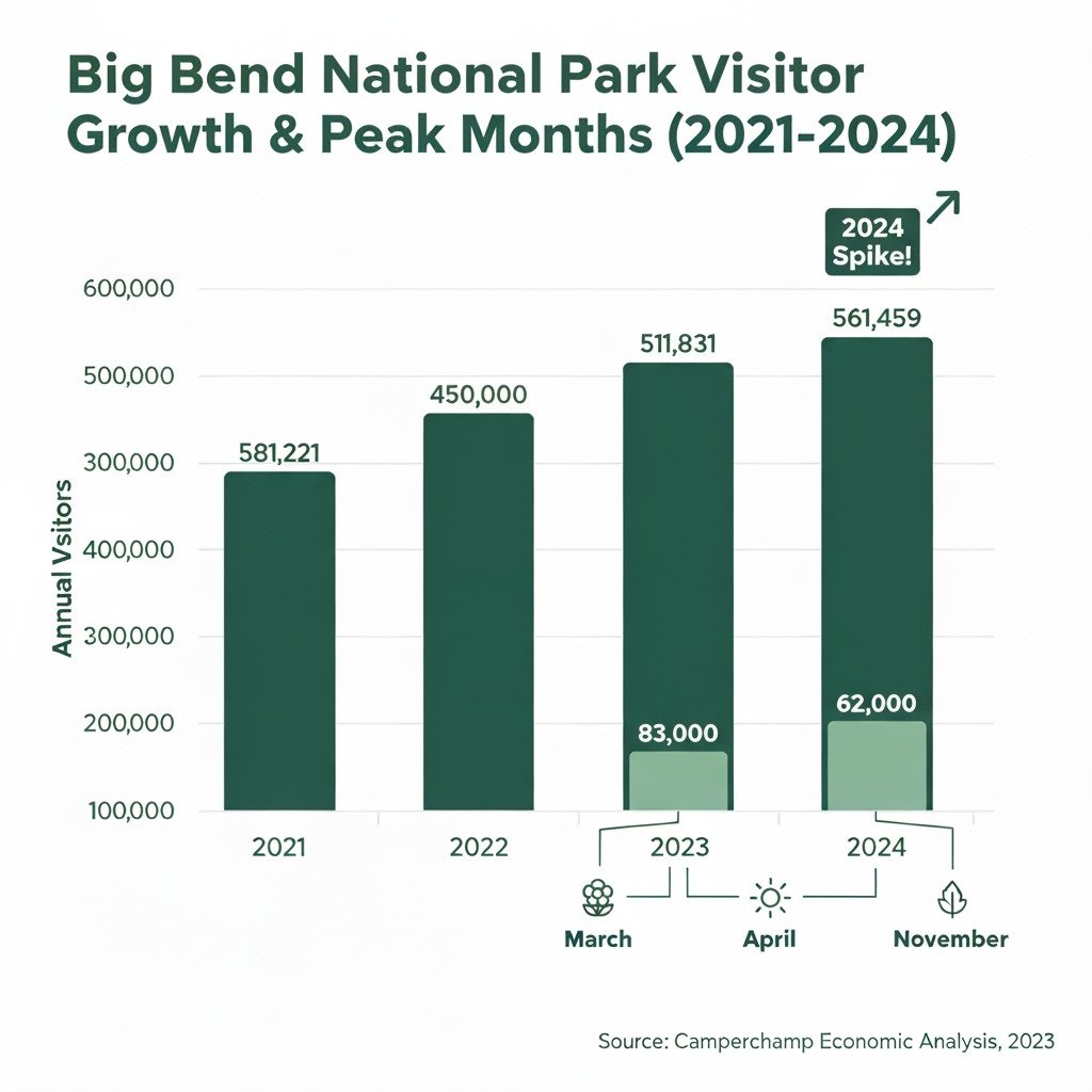
Peak months remain March (~83,000 visitors), April (~62,000), and November (~56,000), necessitating rigorous advance planning. Tourist spending climbed to $48.51 million in 2023, a 17% jump over pre-pandemic levels.
From my three visits to Big Bend over the past five years, I’ve witnessed this transformation firsthand. The Chisos Basin parking lot that once had available spots at 10 AM now fills by sunrise during peak season. This surge places considerable strain on the park’s water, waste, and emergency systems, underscoring the vital need for preparedness.
Critical Infrastructure Limitations You Must Understand
Big Bend’s vastness and remote location present unique logistical hurdles that can derail unprepared visitors. Understanding these challenges prevents trip failures.
Fuel Scarcity Distribution Network
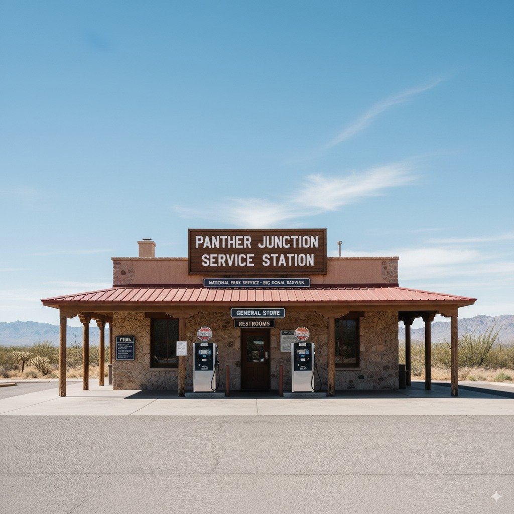
Panther Junction: A vital, but limited, fuel stop serving the entire park.
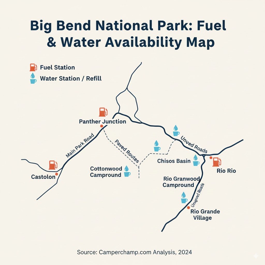
The park’s 801,000 acres contain only two permanent fuel stops, making careful fuel management essential for all visitors, especially RV drivers exploring remote sections:
- Panther Junction Service Station (central location; pumps operate 24/7, store hours vary)
- Rio Grande Village Service Station (eastern location; fuel availability limited to store hours)
The nearest external stations—Study Butte (14 miles west) and Lajitas (7 miles west)—leave western routes like Ross Maxwell Scenic Drive without services for 30+ miles. RV drivers must heed the vehicle-length restrictions on Chisos Basin Road (trailers over 20 feet and RVs over 24 feet discouraged) due to steep grades and tight turns that significantly impact fuel efficiency.
Water Management Critical Points
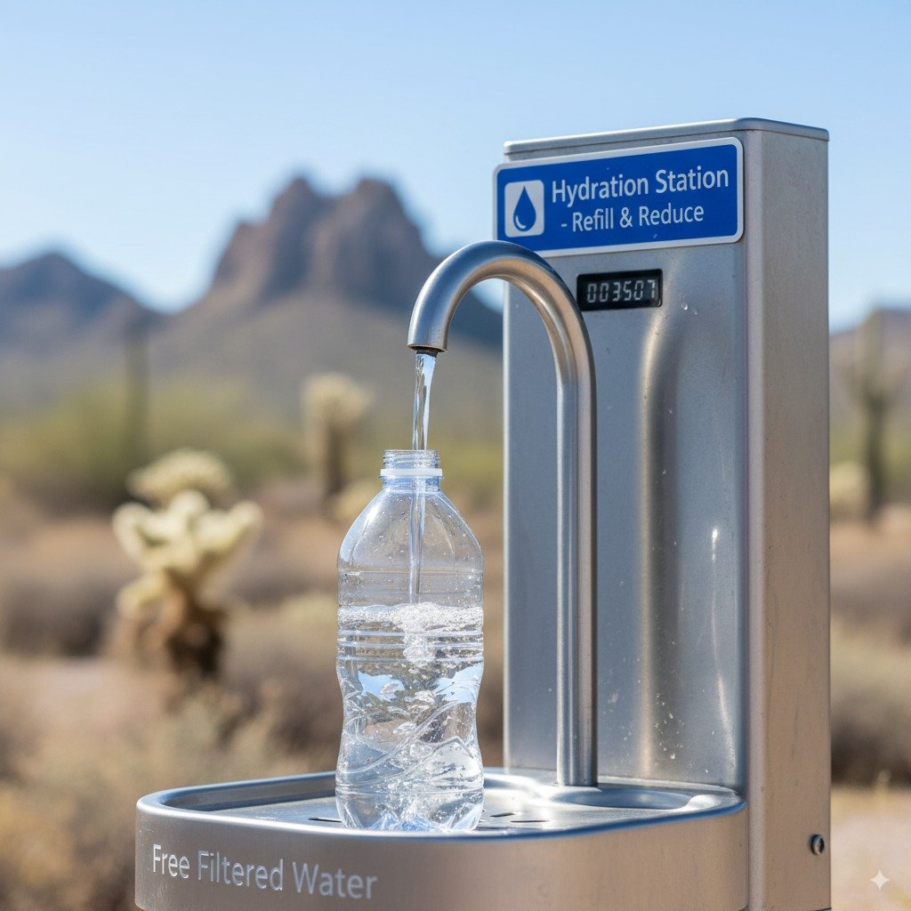
One of only three reliable water sources within Big Bend’s 801,000 acres.
Potable water remains scarce throughout the desert. Sources exist only at visitor centers and three designated bottle-fill stations—Panther Junction, Rio Grande Village, and Chisos Basin.
This scarcity makes self-sufficiency paramount for any activity, from short hikes to multi-day backcountry excursions.
Desert Survival Protocols: Data-Driven Safety Solutions
Surviving Big Bend’s harsh environment requires specific protocols based on measurable risk factors and resource distribution patterns.
Mile-by-Mile Resource Management Chart
| Route Segment | Distance | Fuel Availability | Water Sources | Critical Safety Notes |
|---|---|---|---|---|
| Santa Elena Canyon → Castolon | 0-8 miles | None | None | Last water at Cottonwood Campground |
| Castolon → Sotol Vista | 8-22 miles | None | None | Carry minimum 2 gallons per person for hikes |
| Sotol Vista → Panther Junction | 22-30 miles | Panther Junction (24/7 pumps) | Panther Junction Visitor Center | Fuel store closes 6 PM; use card after hours |
| Panther Junction → Chisos Basin | 0-6 miles | None | Chisos Basin Visitor Center | Steep grades reduce fuel efficiency by 15-20% |
| Chisos Basin → Rio Grande Village | 6-27 miles | Rio Grande Village (store hours only) | RGV Store and Visitor Center | No services en route; plan fuel accordingly |
| Rio Grande Village → Boquillas | 0-5 miles | None | RGV Station | Border crossing closed Tuesday-Wednesday |
Cross-Border Emergency Response Protocols
The Boquillas Port of Entry provides critical emergency access to Mexican medical facilities when U.S. services require helicopter evacuation:
- Immediate Response: Activate satellite beacon and record precise GPS coordinates
- Ranger Notification: Alert rangers via park call-box (Panther Junction/Chisos Basin) or satellite messenger
- Border Access: Present passport at Boquillas POE (open 9 AM-4 PM, Friday-Monday summer; Wednesday-Sunday winter)
- Medical Transport: Arrange local ambulance transport to Hospital Múzquiz (approximately 2.5 hours south)
- Insurance Verification: Ensure travel insurance covers Mexican medical care; Global Rescue membership recommended for comprehensive evacuation coverage
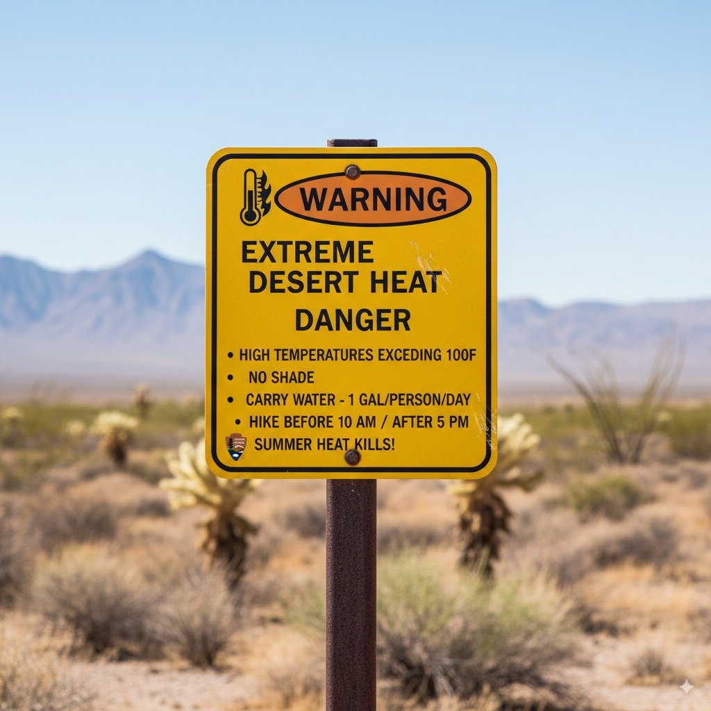
Heat Index Safety Decision Matrix
| Temperature °F | Heat Index Risk | Recommended Activity Level | Required Hydration Protocol |
|---|---|---|---|
| 85-90°F | Low Risk | Moderate hiking permitted | 0.5 liters per hour + electrolytes |
| 91-97°F | Moderate Risk | Short trails only (<2 miles) | 1 liter per hour + electrolyte tablets |
| 98-103°F | High Risk | Dawn/dusk activity only | 1.5 liters per hour + cooling towel |
| 104°F+ | Extreme Risk | No hiking advised | Immediate shelter, emergency beacon activation |
Strategic Trip Planning: Timeline and Resource Framework
Success in Big Bend requires systematic planning aligned with park infrastructure limitations and seasonal demand patterns.
Reservation Timeline Strategy
Camping reservations follow predictable patterns that demand strategic timing:
- 6 Months Out: Reserve preferred campsites at Chisos Basin, Rio Grande Village, or Cottonwood campgrounds via Recreation.gov
- 4 Months Out: Obtain backcountry permits for extended treks (Marufo Vega, Outer Mountain Loop)
- 2 Months Out: Reserve specialized gear rentals (water filters, cooling vests, additional fuel containers)
- 72 Hours Pre-Trip: Confirm current fuel availability at both park stations (432-477-2251)
Reserve Your Big Bend Campsite Now
Essential Self-Sufficiency Gear Checklist
Critical gear categories for Big Bend self-sufficiency.
- Water Systems: Collapsible 10-liter containers for bulk storage, gravity filtration system for emergency sources
- Emergency Communication: Garmin inReach Mini 2 satellite communicator, physical topographic maps
- Thermal Management: Electrolyte tablets, wide-brimmed UV protection hat, evaporative cooling scarf
- Vehicle Preparedness: Full-size spare tire, tire repair kit, minimum 5 gallons spare fuel in certified container
During my 2022 winter visit, temperatures dropped to 28°F at Chisos Basin while Rio Grande Village remained at 45°F. Pack layers for 40-degree elevation-based temperature swings.
Seasonal Activity Optimization Strategy
- November-April (Peak Season): Ideal hiking conditions with temperatures 61-77°F. Reserve by August. Pack cold-weather layers for higher elevations.
- May-June & September-October (Shoulder Season): Expect significant temperature swings. Schedule hikes before 10 AM or after 4 PM. Cottonwood Campground provides river access for cooling.
- July-August (Extreme Heat): Average temperatures 88-94°F. Limit strenuous activities. Focus on river corridors. Use Rio Grande Village showers for cooling.
Emergency Response Decision Trees
Medical Crisis Response Flowchart
Water Emergency Contingency Protocols
Water failure requires immediate systematic response to prevent life-threatening dehydration:
- Immediate Rationing: Divide remaining supply by estimated time until rescue or reaching known water source
- Shade Creation: Construct emergency shelter using reflective blankets or natural shade to reduce perspiration fluid loss
- Solar Still Construction: Last resort emergency measure – dig collection pit, place container, cover with plastic sheeting for condensation collection
- Aerial Signaling: Create large ground “X” with rocks or gear for helicopter spotting, use signal mirrors during daylight
Regional Infrastructure and Navigation Resources
Access these official, always-updated resources for navigation and service confirmation:
- Official NPS Big Bend Maps Hub – Complete collection including brochure maps, area-specific maps, and detailed Chisos Basin/Rio Grande Village layouts
- Current Goods & Services Status – Real-time confirmation of fuel availability, grocery supplies, and shower facilities
- Panther Junction Service Station Details – 24/7 pump access and store inventory information
Responsible Visitation Framework
Preserving Big Bend’s ecosystem while managing record visitation requires enhanced stewardship practices.
Desert-Specific Leave No Trace Protocols
Desert environments require specialized conservation approaches beyond standard Leave No Trace principles.
- Water Conservation: Limit shower use at Rio Grande Village facilities to 3 minutes due to extreme regional scarcity
- Waste Management: Use WAG bags for all backcountry human waste; pack out ALL toilet paper (burial ineffective in arid climate)
- Cultural Sensitivity: Support responsible tourism when visiting Boquillas; avoid purchasing undocumented artifacts
Permit Compliance and Documentation
- Detailed Itinerary Filing: Submit comprehensive trip plans at Panther Junction kiosk before any backcountry travel
- Permit Documentation: Carry printed copies of all permits (backcountry, camping reservations) throughout your visit
- Waste Protocols: Remember all toilet paper must be packed out – desert burial is insufficient
Essential Digital and Emergency Resources
The NPS Mobile App provides crucial offline functionality for Big Bend’s communication dead zones.
- Real-Time Visitor Statistics Dashboard – Current visitation trends and fuel availability updates
- Offline Trail and Safety Maps – Critical for navigation in zero-service areas via NPS Mobile App
- Campground Availability Alerts – Set notifications for desired campsites to capture cancellations
Critical Success Factors for Your 2025 Big Bend Adventure:
- Advanced Booking Required: Campgrounds sell out 6 months ahead – secure reservations on Recreation.gov
- Water Self-Sufficiency: Carry minimum 1 gallon per person daily – natural sources virtually nonexistent
- Fuel Strategic Planning: Only two park stations exist – carry spare fuel especially for western routes
- Communication Backup Systems: Cellular service covers less than 10% of park – satellite communicators essential
- Emergency ProtocolFeatured Image Credit: National Park Service


